|
|
|
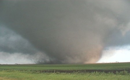
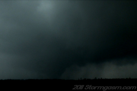
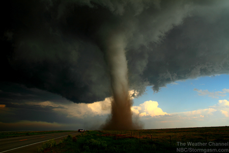
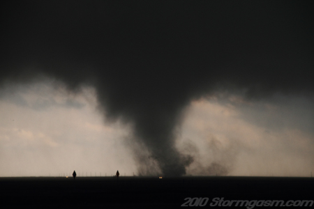
March 22, 2011: Iowa Tornadoes March 22, 2011: Juston and Simon documented two tornadoes, amazing structure, and large hail in Central Iowa. One of the tornadoes was a rain-wrapped cone southeast of Massena or southwest of Bridgewater, IA. A second larger tornado circulation was documented northwest of Winterset, IA, but it quickly became wrapped in rain obscurring the tornado. There were very fast storm motions (45-55mph) on this day making it very difficult to chase the tornadic supercells. |
 |
|
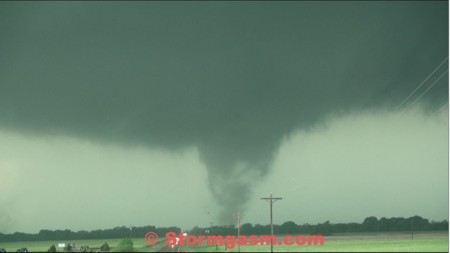
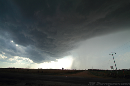
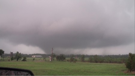
March 8, 2011: Clarksville, TX Tornado March 8, 2011: Tom, Simon and Jim documented a large rain-wrapped wedge/cone/stovepipe/multivortex tornado west of Clarksville, TX. The storm was a large high precipitation supercell moving quickly to the east-northeast at 40 to 50mph making it very difficult and dangerous to chase. Jim was able to witness another rain wrapped tornado prior to the Clarksville tornado southwest of Paris, TX, but no decent footage or photographs were taken of this tornado. |
 |
|
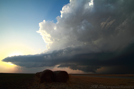
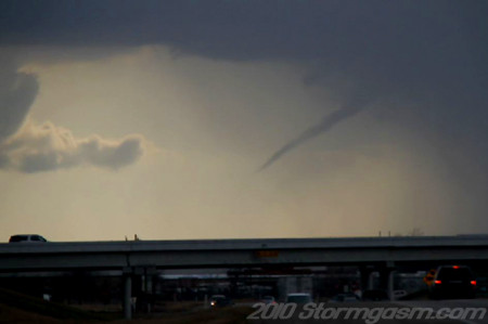
February 27, 2011: Oklahoma Tornadic Supercell February 27, 2011: Simon documented a supercell thunderstorm in Northcentral Oklahoma and Southeast Kansas. The supercell produced a tornado (possibly two) while Simon repositioned. Great structure, high winds, and large hail was documented with this Early Season storm. |
 |
|
February 24, 2011: Oklahoma Linear Storm February 24, 2011: Simon documented a linear single-cell thunderstrom near Bromide, OK. The storm produced high winds and small hail; a great early start to a chase season. |
 |
|
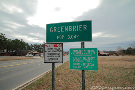
February 23, 2011: Arkansas Earthquakes February 23, 2011: Simon documented 3 small earthquakes in Greenbrier, AR. This was his first "Earthquake chase". |
 |
|
February 9, 2011: Oklahoma Snowstorm and Record Low Temperatures February 9, 2011: Simon documented a large snowstorm in central and northern Oklahoma, which setup an environment for the all time record low temperature to be broken at -31 deg F in northeastern Oklahoma. |
 |
|
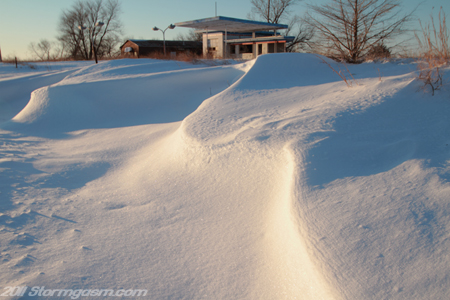
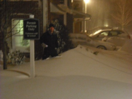
December 26-27, 2010: Northeast Blizzard December 26, 2010: Jim documents an intense Northeast blizzard on the afternoon and evening of December 26, and the early morning of December 27 in Connecticut. Watch two six minute videos highlighting his experience, along with photos from the event. |
 |
|
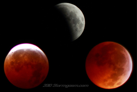
December 21, 2010: Total Lunar Eclipse December 21, 2010: It's the first day of winter, but that's not all that made this day significant. A total lunar eclipse occured during the winter solstice. Simon braved the cold in the early morning hours and documented the event in Oklahoma.
Click on the picture to the right to go to chase page. |
 |
|
May 31, 2010: Campo, CO Tornado May 31, 2010: Simon Brewer and Juston Drake documented two amazing tornadoes on a high-based supercell in southeastern Colorado and the Oklahoma Panhandle. Click on the picture to the right to go to chase page. |
 |
|
November 21, 2010: Jim updates his bio page -- adds videos Jim has made several YouTube clips of TV shows that he has appeared on over the years. One of them has both him and Simon talking about the 2.5 mile wide tornado on May 22, 2004 that passed near Wilber, NE. Jim also added his presentation from the Tri-State Weather Conference on October 9, 2010. Click here to go to Jim's bio page, or click on the picture to the right. |
 |
|
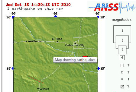
October 13, 2010: Norman, OK Earthquake October 13, 2010: Simon Brewer experienced a 4.3 magnitude earthquake, which was centered ~5 east of Norman, OK. Simon woke to his apartment shaking and to a 'rumble' sound. Objects in his room were shaking and his bed was swaying back and forth. This was a relatively strong earthquake for Central Oklahoma. Click on the picture to the right to go to chase page. |
 |
|
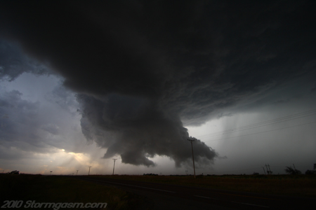
October 10, 2010: West Oklahoma Supercell October 10, 2010: Simon Brewer documented a supercell (elevated/outflow dominant, but sometimes surface-based) over western Oklahoma. The storm developed near Hobart, OK and tracked eastward along a stalled cold front boundary. The storm produced great structure, high winds, small hail, and frequent lightning. Click on the picture to the right to go to chase page. |
 |
|
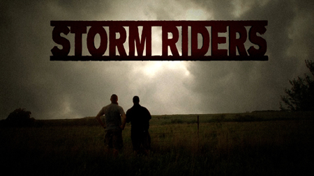
September 11, 2010: New "Storm Riders" Episodes September 2, 2010: New episodes of The Weather Channel Series "Storm Riders" will air beginning September 11, 2010. The series follows Simon Brewer and Juston Drake as they document tornadoes and storms. Click on the picture to the right to go to chase page. |
 |
|
June 24, 2003 Videos added to Video Gallery Page After seven years, the amazing video captured by Jim Bishop and Reed Timmer on June 24, 2003 in both Woonsocket and Manchester, South Dakota are now avialable to watch on YouTube. What's even beter is these videos are viewable on the Video Gallegy page. Just click on the tornado picture to the right, and enjoy watching some of Stormgasm's most spectacular tornado footage! |
|
|
April 22, 2010 Tornado Chase added Simon Brewer and Juston Drake document multiple tornadoes in the Texas Panhandle. Click on the picture on the right to see the storm chase page for this event. |
 |
|
May 10 Storm Chase Page Created August, 2010: The photos and video stills from Jim and Maryleigh's May 10 storm chase in OKlahoma and Kanasas are finally on the website. Check them out here on the May 10, 2010 storm chase page. |
|
|
May 10 Video added to the Video Gallery Page August, 2010: The May 10, 2010 tornado footage is now viewable on the Video Gallery Page. Watch as Jim Bishop and other Stormgasm.com chasers see quite a few tornadoes; some up close.
|
 |
|
March 18, 2010: "Storm Riders" on The Weather Channel March 18, 2010: Juston Drake and Simon Brewer appear in "Storm Riders" on The Weather Channel April 4th, 2010. "Storm Riders" is an hour long and follows storm chasers Juston Drake and Simon Brewer across the Great Plains as they put their meteorology and storm chasing expertise to the test in search of tornadoes.
Click on the picture to the right to go to Storm Riders webpage. |
|
|
February 21, 2010: Kaufman County, TX Supercell and Funnel February 21, 2010: Simon Brewer documented a supercell and two funnel clouds in Kaufman County, TX. Simon executed a relatively difficult forecast and storm chase in the Dallas-Fort Worth Metroplex. A small region of surface-based instability, an outflow boundary, and marginal shear provided an environment favorable for a supercell to develop in North-Central Texas. Click on the picture to the right to go to chase page. |
 |
|
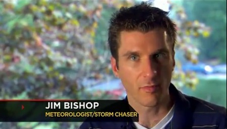
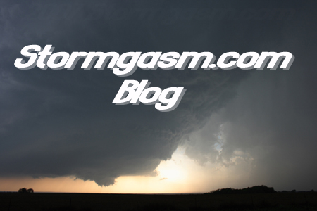
February 2, 2010: Stormgasm.com Blog February 2, 2010: Jim Bishop has created a new Stormgasm.com Blog. The past several years Stormgasm.com members/chasers have attempted to inform the great readers and fans of Stormgasm.com of major weather events, forecasts, and chases. The Stormgasm.com members/chasers have been very busy and at times have not been able to update the website in a timely manner. Now, Stormgasm.com members/chasers can update Stormgasm.com readers, followers, and fans on major weather events, forecasts, and chases with the new blog. Click on the picture to the right to go to the new Stormgasm.com Blog. |
 |
|
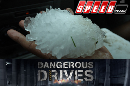
January 7, 2010: "Dangerous Drives: Storm Chasers" January 7, 2010: Simon Brewer and Juston Drake appear on the new Speed Channel program "Dangerous Drives: Storm Chasers". The focus of the show is jobs, which require driving in dangerous situations, and this episode is on storm chasing. The storm chasing vehicle is the real star of the show, which is why it many shots involve either the interior or exterior of vehicles. The Oregon, MO monster 5.25 inch hailstone appears in the episode. Here is a link to the website for the show: http://www.speedtv.com/programs/dangerous-drives/ Below are times when the show will air: 1/12/10: 10pm ET 1/13/10: 2am ET 1/13/10: 10am ET
|
 |
|
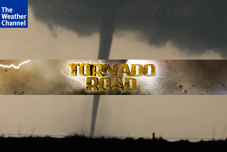
January 7, 2010: "Tornado Road" on The Weather Channel January 2010: Simon Brewer and Juston Drake appear on The Weather Channel show "Tornado Road". The show first appeared on The Weather Channel in fall of 2009 and will continue to air into 2010. The show follows a variety of storm chasers in pursuit of storms in the Great Plains and a hurricane in Louisiana. Simon and Juston intercept a variety of storms in "Tornado Road including; a monster bow echo in Iowa and Category 2 Hurricane Gustav in Louisiana.
|
 |
Page updates by Jim Bishop
Home
| Storm Store | Photo
Gallery | Stormtalk | Storm
Chases | Latest News
Stock Footage | About
| Contact | Editorial
| Weather Links