March 22, 2011 Iowa Tornadoes
|
March 22, 2011: Juston Drake and Simon Brewer documented two tornadoes in Central Iowa along with multiple supercells and large hail. The tornadoes were located near Massena/Bridgewater and Winterset, IA. Report: We started the day in Nebraska City, NE; the target was southeastern and central Iowa along and south of a well-defined warmfront boundary. Cells developed in the late afternoon along a surging surface trough/pacific front in northcentral Kansas and eastern Nebraska. Fast winds aloft created conditions for fast storm motions (45-55mph), so we waited for storms to move closer to the warmfront in Iowa, which would provide better conditions for storms to produce tornadoes (deeper moisture and better low-level shear) before attempting to intercept a storm. The best looking cell developed in northcentral KS and raced toward southeastern Nebraska, so we repositioned further north and east to remain ahead of the developing storm.
The image on the right is a photograph looking south-southwest at a storm near Nebraska City, NE. This storm had a very high base because it was over a region with relatively high dewpoint depressions near the surface (around 80 deg F temp and 49 deg F dewpoint temp). |
 |
|
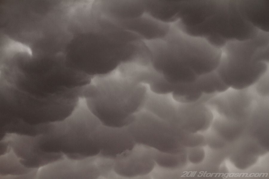
The image on the right is a photograph looking up at mammatus under the anvil of the approaching storm, which was located near Nebraska City, NE. |
 |
|
The image on the right was taken east of Glenwood, IA looking south-southwest at a developing supercell near Nebraska City, NE. The supercell began to develop a lower base around the time of this photograph. |
 |
|
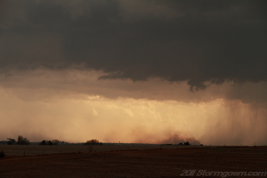
The image on the right was taken east of Glenwood, IA looking south-southwest at a plume of dirt or smoke blown by outflow behind the updraft base of a storm near Nebraska City, NE. It appeared to be smoke fanned by the high winds, but it was too far to be certain. |
 |
|
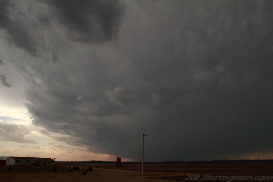
We drove east on SR 34 and eventually went north on SR 59 and east on SR 92; the storm was moving very quickly to the northeast and we had to punch through the core of the storm to regain position on the updraft. We emerged out of the rain and hail (golf ball-sized hail) near Massena, IA and drove a few miles to the east just west of Bridgewater, IA. We were presented with an amazing view of the strengthening HP supercell with great structure and a rotating wall cloud.
The image on the right is looking south-southwest at a rotating wall cloud west-southwest of Bridgewater, IA. Notice the dark and wet RFD, which is why this is a high precipitation (HP) supercell. Small and large hailstones were falling at the time this picture was taken. |
 |
|
The image on the right is looking south-southwest at a rotating wall cloud west-southwest of Bridgewater, IA. Notice the dark and wet RFD, which is why this is a high precipitation (HP) supercell. Small and large hailstones were falling at the time this picture was taken. |
 |
|
The image on the right is looking south-southwest at a rotating wall cloud west-southwest of Bridgewater, IA. Hailstones (dark streaks in the foreground) can be seen in this photograph. The wet RFD was wrapping around the east side of the wall cloud at this time. |
 |
|
The image on the right is a video still looking south-southwest at a rotating wall cloud west-southwest of Bridgewater, IA. The storm was took a turn to the right around this time moving more east-northeast instead of due northeast and it appeared to decrease its speed (probably moving ENE at 45 mph instead of NE at 55mph). |
 |
|
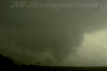
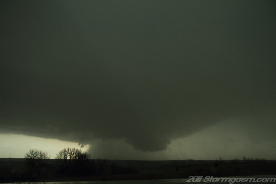
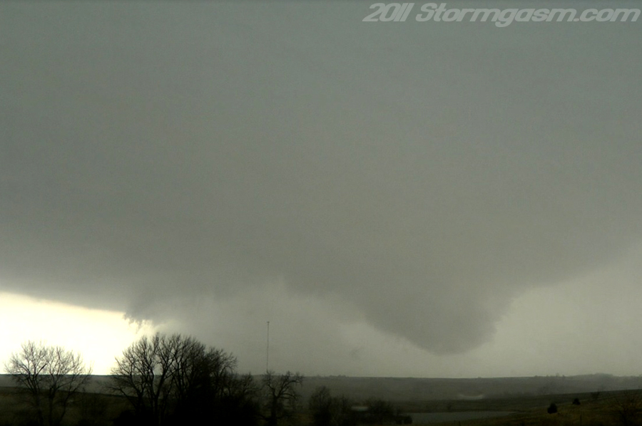
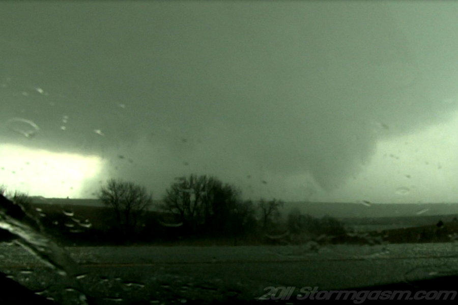
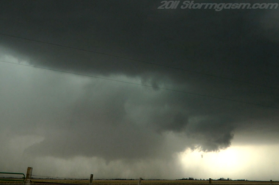
The RFD was really occluding the wall cloud causing rapid rotation and a ragged funnel cloud developed. The funnel then took more of a cone appearance and showed rapid motion. The cone funnel appeared to hover just above the ground a few miles to our south with increasing amounts of rain wrapping around the vortex making it difficult to see if debris was at the surface, so we waited for the NWS damage survey to confirm this was a tornado, which the did a few days after the chase. We were on a large hill (what appeared to be a local highpoint), so we had a very good vantage point for this tornado, so the following images really show how close the condensation funnel was to the ground. The image on the right is a video still looking south-southwest at a cone tornado west-southwest of Bridgewater, IA; NWS Des Moines, IA damage survey confirmed this was a tornado. |
 |
|
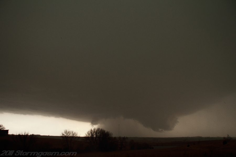
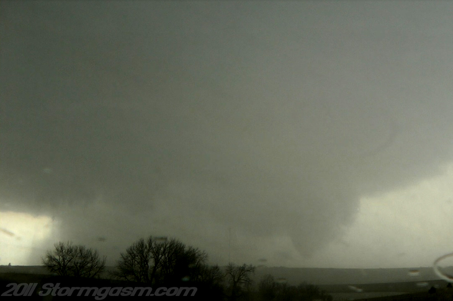
The image on the right is a video still looking south-southwest at a cone tornado west-southwest of Bridgewater, IA; NWS Des Moines, IA damage survey confirmed this was a tornado. |
 |
|
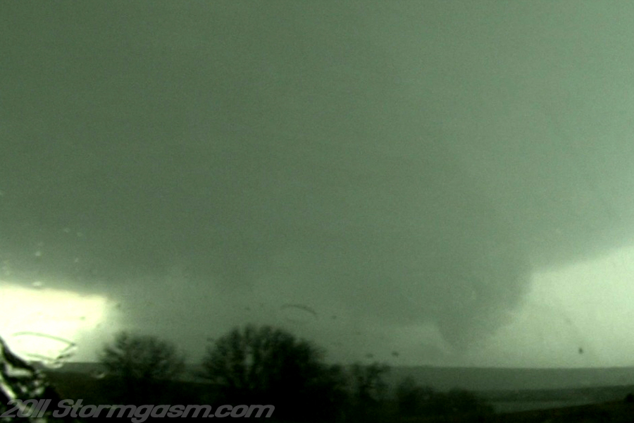
The image on the right is a video still looking south-southwest at a cone tornado west-southwest of Bridgewater, IA; NWS Des Moines, IA damage survey confirmed this was a tornado. |
 |
|
The image on the right is a video still looking south-southwest at a cone tornado west-southwest of Bridgewater, IA; NWS Des Moines, IA damage survey confirmed this was a tornado. |
 |
|
The image on the right is a video still looking south-southwest at a cone tornado west-southwest of Bridgewater, IA; NWS Des Moines, IA damage survey confirmed this was a tornado. |
 |
|
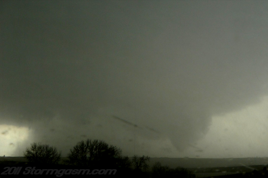
The image on the right is a video still looking south-southwest at a cone tornado west-southwest of Bridgewater, IA; NWS Des Moines, IA damage survey confirmed this was a tornado. Too much rain began to wrap around the tornado shortly after this image drastically decreasing the visibility, so we drove just east of Bridgewater and parked on a hill east of town hoping the rain would let up under the updraft. |
 |
|
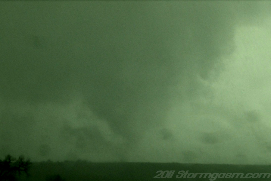
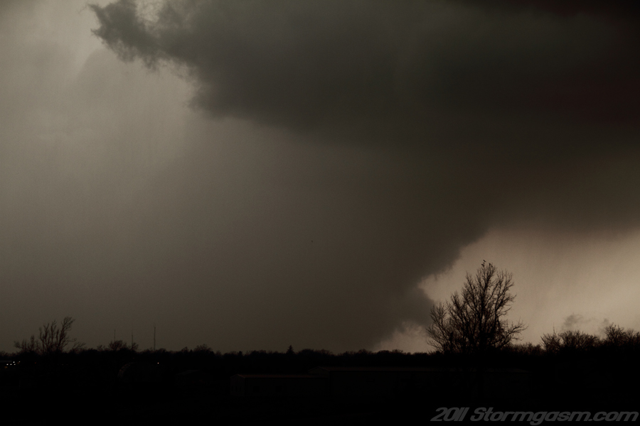
The image on the right is a photograph taken just east of Bridgewater, IA looking west at a rain-wrapped mesocyclone west of Bridgewater, IA. A stubby tail cloud could be seen feeding into the rain signalling there was still a hidden mesocyclone. The large flat base of the supercell was directly over our heads at the time of this photo. |
 |
|
The image on the right is a photograph taken just east of Bridgewater, IA looking west at a rain-wrapped mesocyclone west of Bridgewater, IA. A stubby tail cloud could be seen feeding into the rain signalling there was still a hidden mesocyclone. We thought there still might be a tornado wrapped in the rain. |
 |
|
The rain never let up around the occluded mesocyclone west of Bridgewater, so we drove ENE on SR 92 and the supercell took a little bit of time, but eventually it reorganized and wall cloud quickly developed.
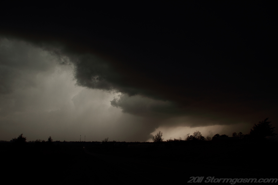
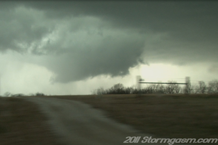
The image on the right is a photograph taken near Stanzel, IA on SR 92 looking NNW at a rapidly developing and rotating wall cloud. |
 |
|
The image on the right is a photograph taken near Stanzel, IA on SR 92 looking NNW at a rapidly developing and rotating wall cloud. |
 |
|
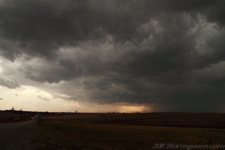
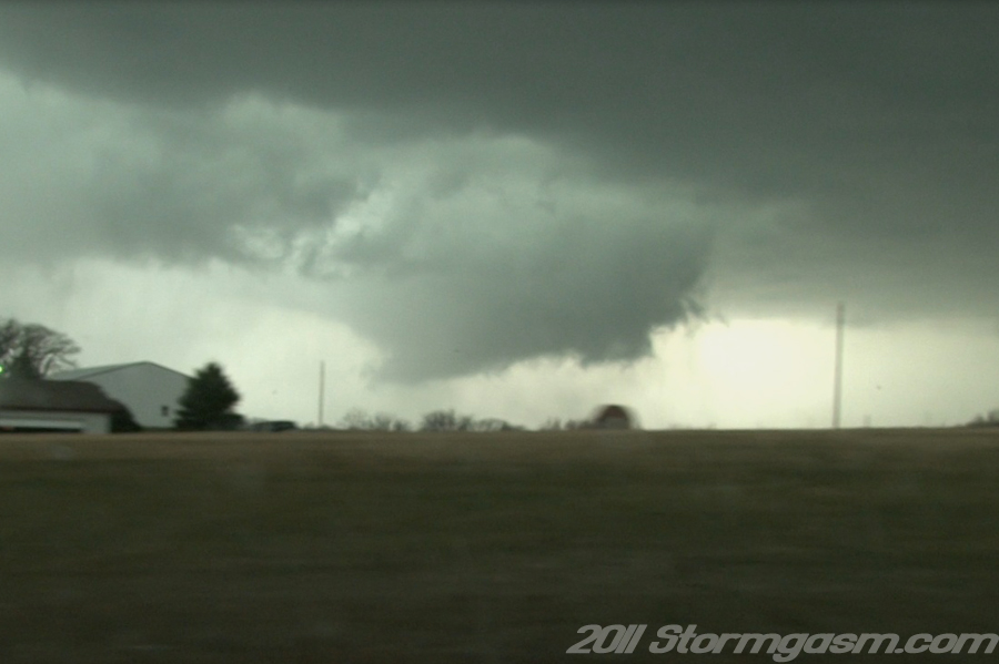
We raced eastward on SR 92 trying to gain ground on the new wall cloud; it was rotating so quickly it could be seen with only a brief glance. We turned north on a dirt/gravel road just west of Winterset, IA and witnessed the amazing rotation of the wall cloud to our northwest. The circulation was very strong and a large dusty circulation was decernable at the surface, while small condensation funnels quickly developed and dissipated under the meso; we consider this to be the beginning of a large tornado circulation northwest of Winterset, IA. The Des Moines, IA NWS damage survey showed tornado damage beginning near this location.
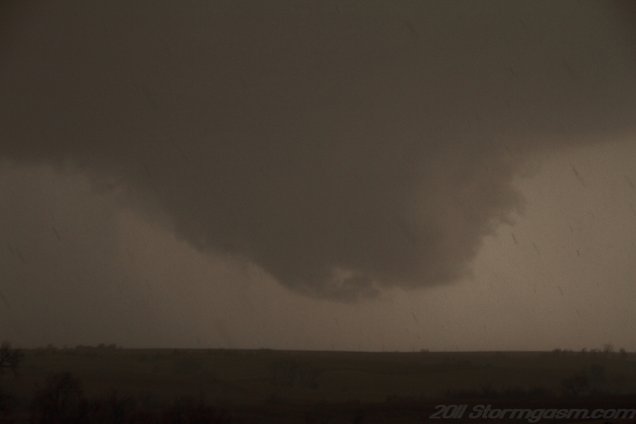
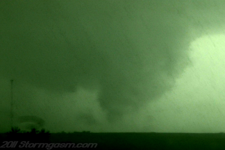
The image on the right is a photograph taken west of Winterset, IA north of SR 92 looking NW at a rapidly developing and rotating wall cloud and brief funnel cloud/tornado northwest of Winterset, IA. The wall cloud was rapidly rotating with strong rotation at ground level with dust kicked-up and brief small condensation funnels providing evidence there was a large tornado circulation under the wall cloud. NWS in Des Moines, IA damage survey confirmed a tornado that began near the location of this image. Rain quickly wrapped around the tornadic circulation from the very wet RFD obscurring any sign of a tornado. The rain-wrapped circulation moved northeast. We followed the rain-wrapped meso for a short time hoping to see a decrease in precip, but it never happened, so we drove east on SR 92 to keep a better position on the storm. We eventually hauled it south to an LP supercell thunderstorm south of Osceola, IA, but the sun had set and the atmosphere was stabilizing near the surface, so it had little chance to produce a tornado. We called it a day and drove west through a line of heavy thunderstorms on SR 2 in the later evening light. |
 |
Home
| Storm
Store | Photo
Gallery | Stormtalk | Storm
Chases | Latest
News
Stock Footage | About
| Contact
| Editorial
| Weather
Links
Copyright 2004 Stormgasm.com. All rights reserved.