October 10, 2010 West Oklahoma Supercell
|
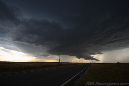
October 10, 2010: Simon Brewer documented an elevated/outflow dominant and sometimes surface-based supercell in western Oklahoma. Report: An upper-level cut-off low was slowly propagating over Nebraska and Kansas and small perturbation waves rotating around the low, which provided lift to initiate storms over Western Oklahoma in the early evening. High-based elevated storms propagated out of western Oklahoma in the late morning and an upper-level clear slot moved over the region in the afternoon, which allowed for significant surface heating. Adequate low-level moisture (surface dewpoints in the low to mid-50's) and relatively cold mid-level air (500mb temperatures around -15 deg C) had advected over the area, so relatively weak, but adequate, surface-based CAPE developed over Southwest Oklahoma and Northwest Texas in the late afternoon. A WSW to ENE oriented stalled cold front was located between S.R. 9 and I-40 over West Oklahoma. Elevated storms developed over the area in the late afternoon, probably due to the mid-level cold air advection and lift associated with the small wave perturbation rotating around the mid-level closed low, but a storm developed in the early evening along the stalled cold front near Hobart, OK. The image on the right is looking northwest at a storm north of Hobart, OK. A lowered base can seen over the trees near the center of the picture indicating the lower portion of the mesocyclone (storm was elevated a few miles north of the cold front boundary at this time). |
 |
|
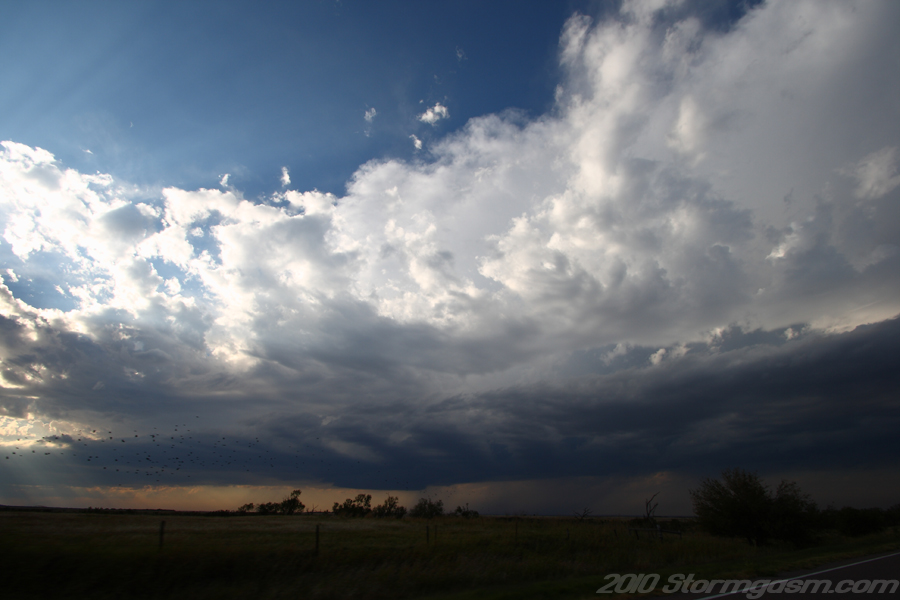
I approached the storm from the east on S.R. 9 just east of Hobart; it had a small hook echo on base reflectivity and the updraft regained position along the cold front becoming surface-based. A wall cloud quickly developed and a tail cloud began to appear.
The image on the right is looking west at the wall cloud and newly developed tail cloud on a supercell storm near Hobart, OK. |
 |
|
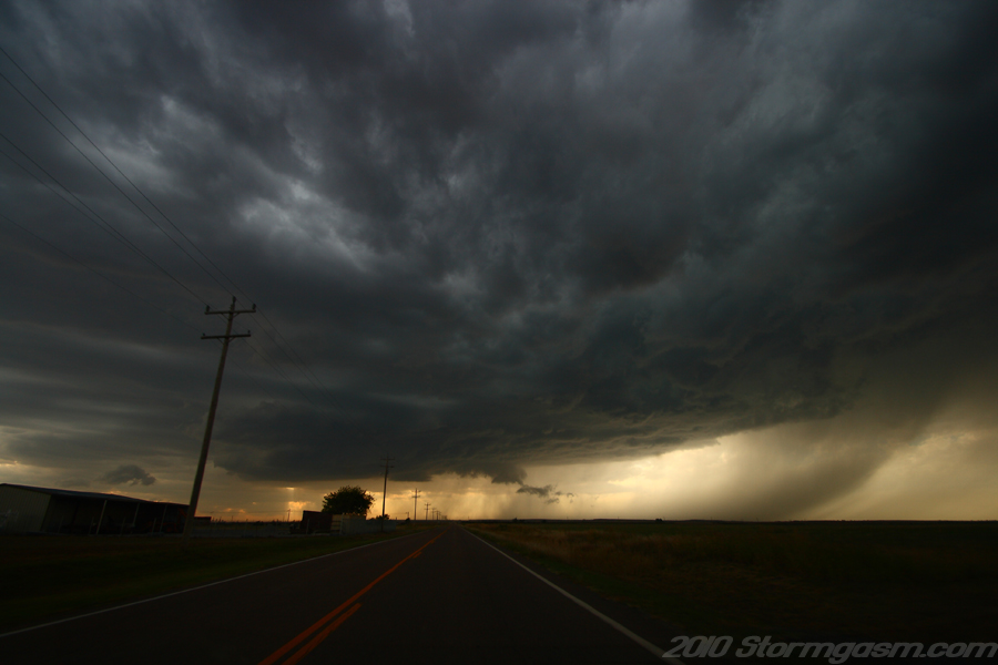
The
supercell continued to intensify and large amounts of dirt was kicked
up by the RFD (could also say RFD enhanced cold front, but there was no
doubt cold air from behind the front was mixing into the RFD).
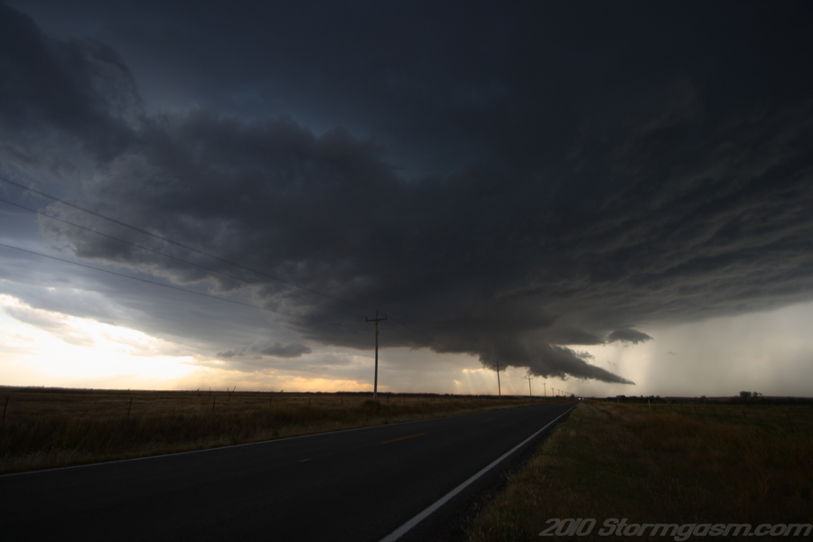
The image on the right is looing west at a well developed supercell along a stalled cold front near Hobart, OK. Notice the long well developed tail cloud feeding into the wall cloud. |
 |
|
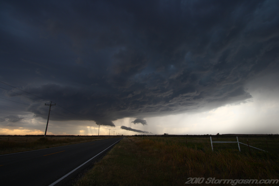
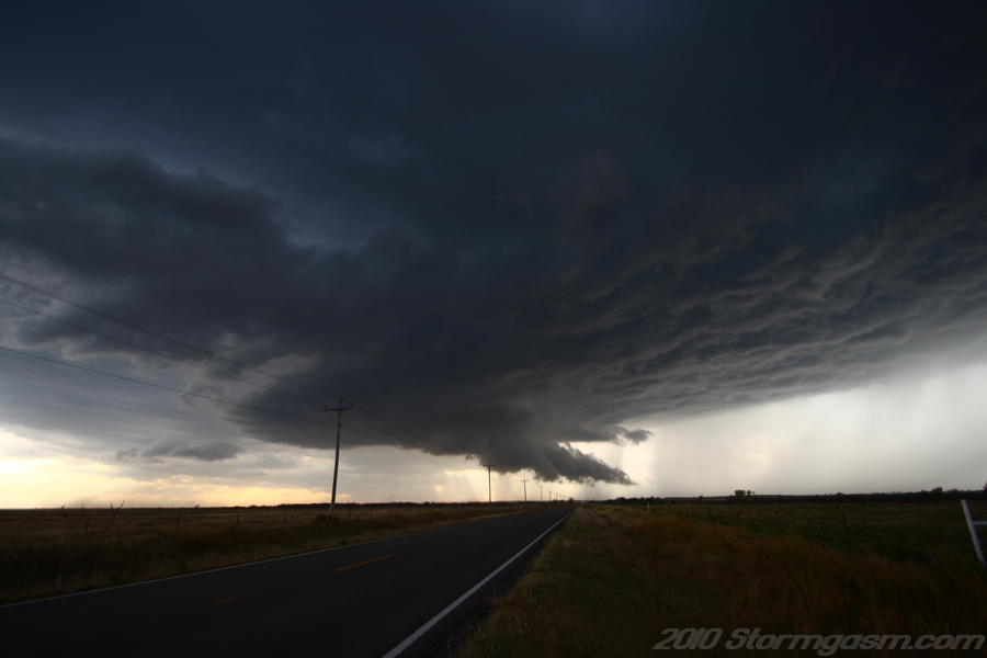
The image on the right is looking west at a well-developed wall cloud east of Hobart, OK. The base of the storm was staying ahead of the cold front. |
 |
|
The image on the right is looking west at a well-developed wall cloud east of Hobart, OK. The base of the storm was staying ahead of the cold front.
|
 |
|
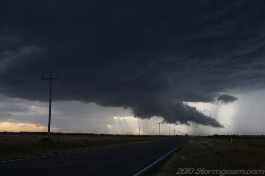
The image on the right is looking west at a well-developed wall cloud east of Hobart, OK. The base of the storm was staying ahead of the cold front. |
 |
|
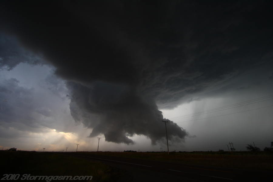
The image on the right is looking west at a well-developed wall cloud east of Hobart, OK. I really thought the storm might had a chance of producing a tornado at this point. The rotation was very rapid, but I think there was too much cold air wrapping around the RFD. There were some nice gustnadoes along the edge of the RFD gust front where it connected with the wall cloud (it's possible one of the gustnadoes could have been a brief tornadic spin up associated with the mesocyclone, but would only be able to confirm with a surface micronet combined with a high resolution mobile radar, but the event was not that important). |
 |
|
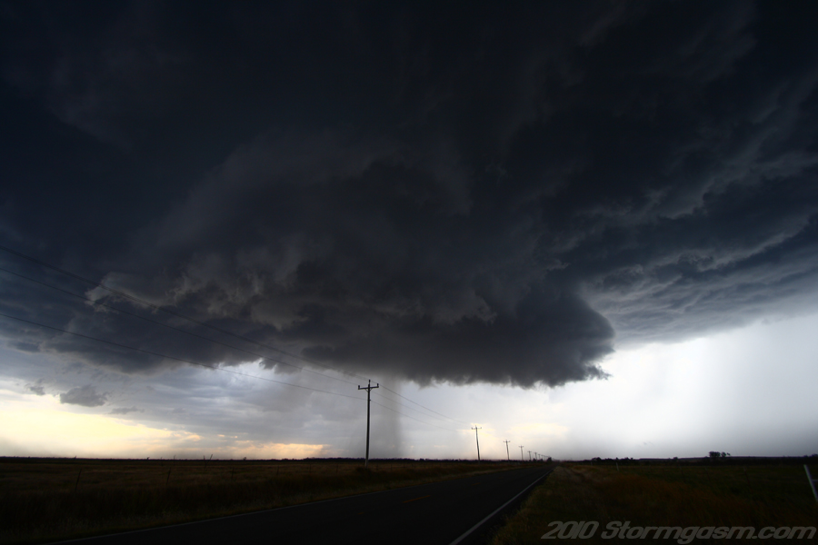
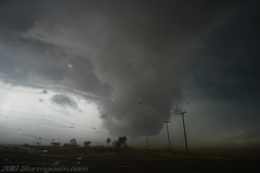
The image on the right is looking west at a wall cloud in western Oklahoma along S.R. 9. The RFD clear slot can be seen to the left of the wall cloud. I thought the was the best chance to get a tornado was around the time of this picture; a cone funnel cloud did develop, but it quickly dissipated. The RFD quickly roared over my location and my car was shaken and pelted with hail and small debris very soon after this picture was taken. |
 |
|
The image on the right is looking north at completely occluded wall cloud remnants along S.R. 9 in western Oklahoma; large amounts of dirt can be seen blowing into the air. My car was being shaken and pelted with penny-size hail and small pieces of debris at the time of this picture. |
 |
|
The RFD (enhanced by the cold front) was almost permanently undercutting the updraft base after the last occlusion, so I raced ahead of the storm to get some structure shots before the sunset.
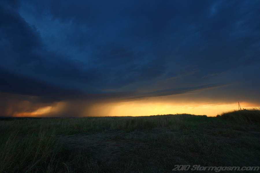
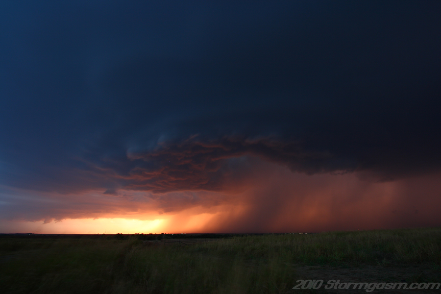
The image on the right is looking northwest at a beaver's tail feeding into a supercell near Fort Cobb, OK. |
 |
|
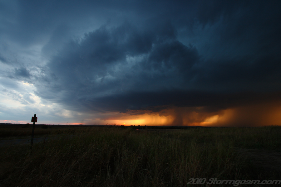
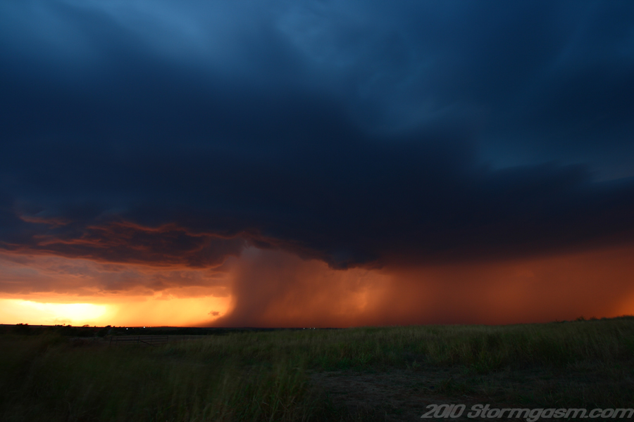
The image on the right is looking west at the elevated/outflow dominant supercell near Fort Cobb, OK. The sun was setting behind the storm at the time of this picture.
|
 |
|
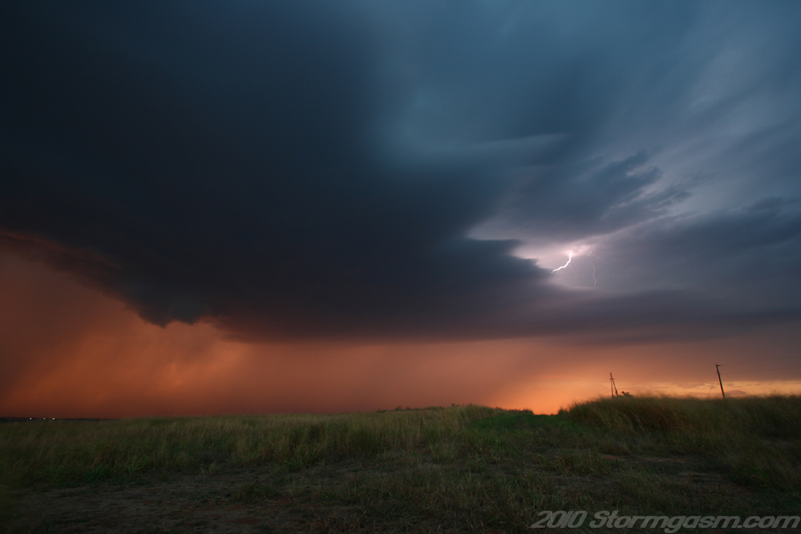
The image on the right is looking northwest at a supercell near Fort Cobb, OK. |
 |
|
The image on the right is looking northwest at a supercell near Fort Cobb, OK. |
 |
|
The image on the right is looking north at a supercell near Fort Cobb, OK. |
 |
|
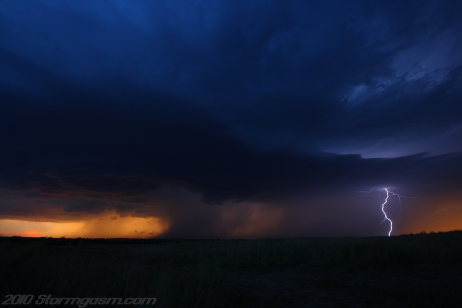
The supercell was west of Anadarko, OK as it became night. I kept pace with the storm as it moved eastward staying ahead of the outflow/cold front. Near Anadarko the storm began to produce frequent cloud to ground lightning (CG's). I finally dropped the storm east of Chickasha, OK. I was definitely surprised by the beauty and strength of this storm. I didn't have high hopes for the day, but I wanted to see some storms, so I drove to western Oklahoma knowing I might only see a line or elevated storms behind a cold front. When this storm developed and initially fell behind the cold front near Hobart I assumed I would be watching a squall line quickly develop, but the storm surprised me and moved ahead of the front periodically often becoming surface-based. There were even times when I thought it might produce a tornado. An 'iffy-day' turned out to be a pretty good day.
The image on the right is looking northwest at a supercell near Fort Cobb, OK. |
 |
Home
| Storm
Store | Photo
Gallery | Stormtalk | Storm
Chases | Latest
News
Stock
Footage | About
| Contact
| Editorial
| Weather
Links
Copyright 2004 Stormgasm.com. All rights reserved.