February 27, 2011 Northern Oklahoma
Tornadic Supercell
|
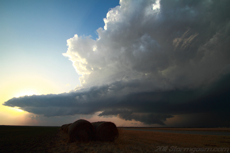
February 27, 2011: Simon Brewer tracked and documented a supercell thunderstorm along the Oklahoma/Kansas border. Simon's Report: I targeted an outflow/pseudo warm front boundary in northern Oklahoma near Blackwell, OK. The dryline bulged in southern and central Oklahoma and sloped northwest intersecting the outflow boundary and cold front in northwestern Oklahoma. A vortmax was evident on watervapor imagery progressing over the Texas Panhandle and moving towards Northwest Oklahoma. Towers began to develop along the dryline on visible satellite imagery and storms soon developed in Northwest Oklahoma. I focused my attention on a small cell near Seiling, OK, which was racing northeastward toward Medford, OK. The storm motion was fast (45-50mph), the dewpoint depressions were relatively large, and the storm was quite young, so I gave it time to develop and drove to Medford and let the storm approach from the southwest.
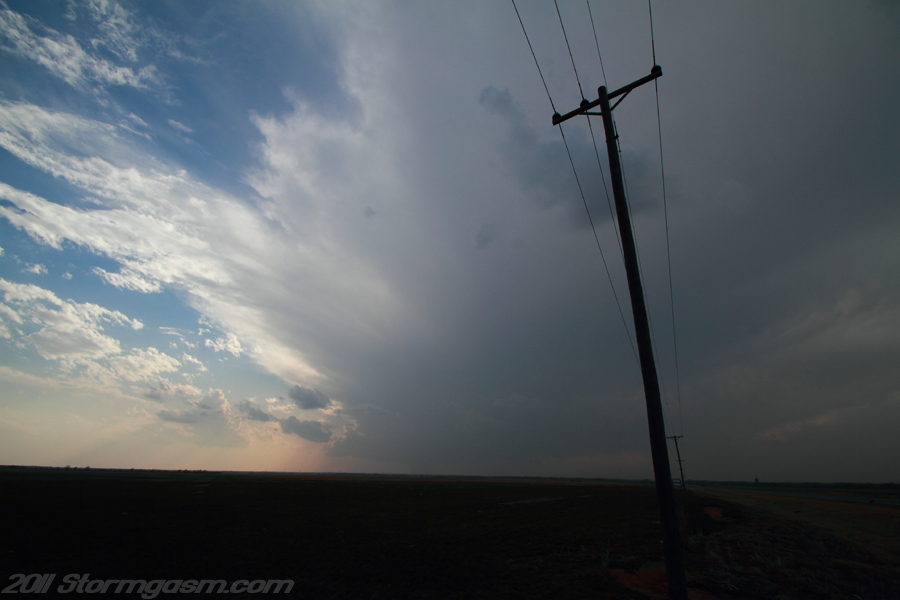
The image on the right is a pic looking west-southwest at a young storm approaching my location near Medford, OK. |
 |
|
The storm had a small high, flat base with a small rain core to its north. As it approached my location a band of clouds developed forming a beaver's tail. The base was relatively high as the storm passed near Medford, so I raced eastward expecting the base to drop as it moved into deeper moisture and closer to the outflow boundary. It's also important to note the storm made a bit of a 'right turn' southwest of Medford and progressed in an east-northeasterly direction.
The image on the right is looking southwest at the young supercell with a newly developed beaver's tail inflow band. |
 |
|
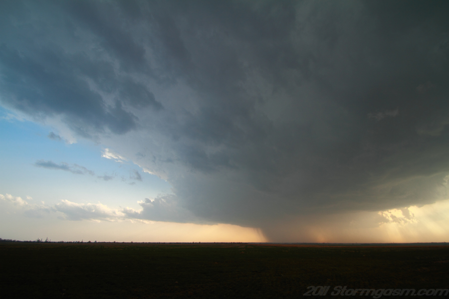
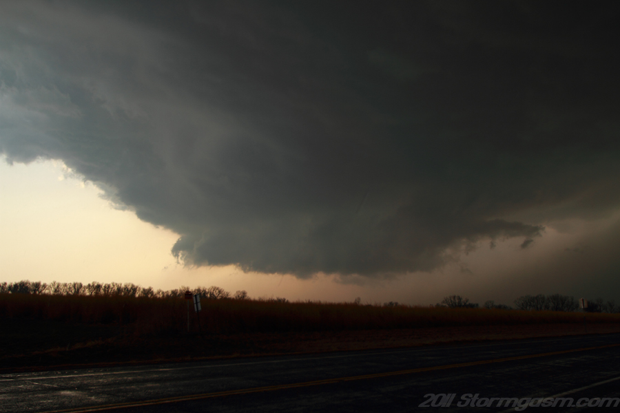
East of Medford the storm began to rapidly intesify gaining an impressive appearance on radar base reflectivity. A wall cloud quickly developed, but seemed to be driven by outflow.
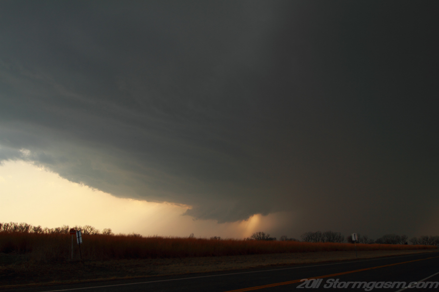
The picture on the right was taken near Deer Creek looking west at the supercell with a newly developed wall cloud. |
 |
|
The picture on the right was taken near Deer Creek looking west at the supercell with a newly developed wall cloud. |
 |
|
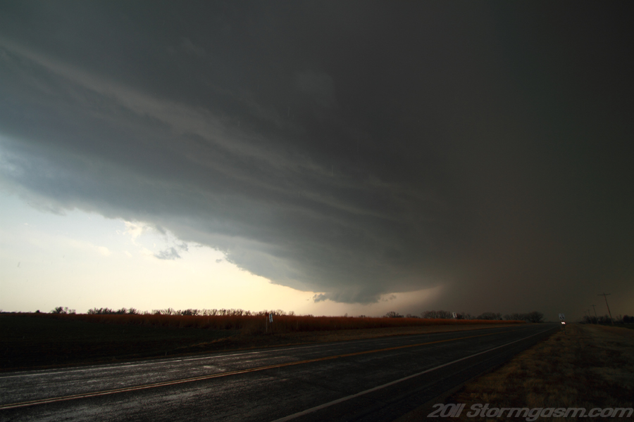
The picture on the right was taken near Deer Creek looking west at the supercell with a wall cloud. |
 |
|
The picture on the right was taken near Deer Creek looking west at the supercell with a wall cloud. |
 |
|
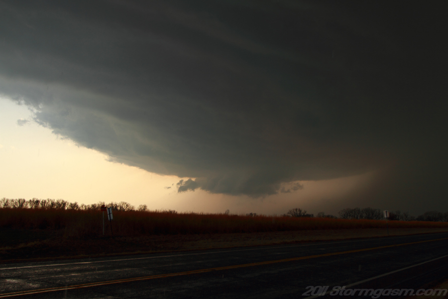
The supercell had great mid-level structure, but the wall cloud seemed to be undercut by outflow. Small hail began to fall around my location and the storm still didn't seem to have it's act together, so I began to drive east to stay ahead of the supercell.
The picture on the right was taken near Deer Creek looking west at the supercell with a wall cloud. |
 |
|
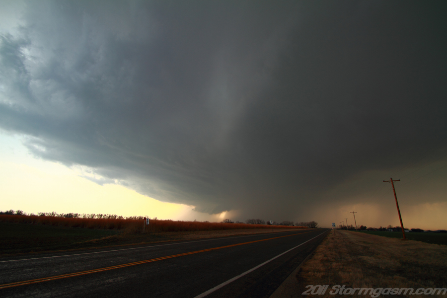
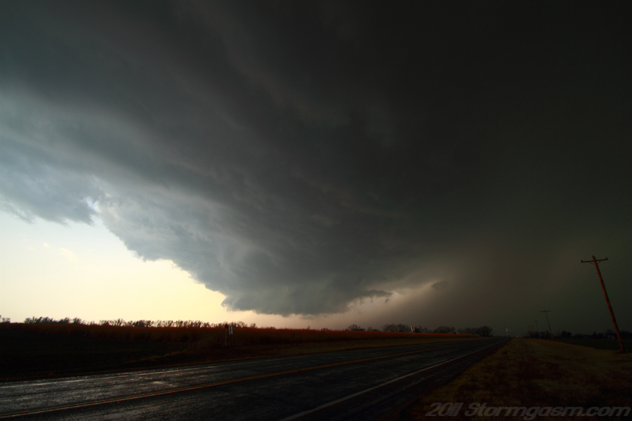
The picture on the right was taken near Deer Creek looking southwest at an approaching wall cloud; small streaks from falling hail can be seen in the photograph. |
 |
|
The supercell went through an occlusion west of Blackwell, but still seemed to be undercut by outflow, so I continued east. Near Newkirk, OK I decided to drive north through Arkansas City, KS, plow through the forward flank downdraft (FFD) and cut in front of the storm instead of risking losing the storm on small dirt roads in Osage County (mistake). While driving through the FFD in Kansas I heard over the radio a tornado was spotted to my south. I got out of the FFD and the storm had stopped producing tornadoes. I left the storm southwest of Independence, KS and drove home. Tough choice when questionable roads are involved with a fast moving storm; I've had the opportunity to make that decision many times and it's outcome has been 50/50. I saw many chasers out on this day; similar to an average chase in May a decade ago, April five years ago, or March several years ago. I've always enjoyed chasing outside of the typical chasing months of April, May, and June, and, now, it appears many others do as well.
The picture on the right is from east of Blackwell, OK looking WNW at a supercell thunderstorm with the sun shielded by the flanking line. |
 |
Home
| Storm
Store | Photo
Gallery | Stormtalk | Storm
Chases | Latest
News
Stock
Footage | About
| Contact
| Editorial
| Weather
Links
Copyright 2004 Stormgasm.com. All rights reserved.