![]()
|
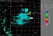
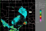
It was a Wednesday, and I had just gotten back from physics lecture. I knew there was a chance for storms in the western Oklahoma/Texas panhandle area. So, I checked out the satellite to see if anything had gone up yet. To my surprise, this is what I saw. |
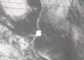 3:46 pm |
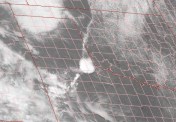 4:04 PM |
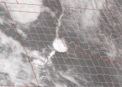
 4:16 PM |
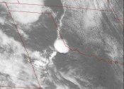
 4:12 PM |
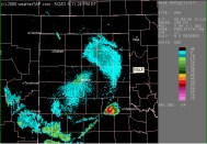
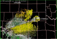
 3:52pm reflectivity |
 3:52pm zoom |
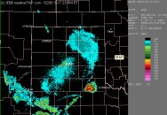
 4:01pm reflectivity |
 4:01pm zoom |
 4:11pm reflectivity |
 4:11pm zoom |
|
By now, I had already called Simon and Tom. I wasn't sure whether or not it was going to be worth it to drive all the way out to southwestern Oklahoma to catch this storm, where it would likely be by the time we would arrive. So, we decided to wait a few more minutes. If the cell holds its own and stays together, we'll leave. If not, then forget about it! |
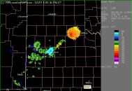
 4:17pm reflectivity |
 4:17pm zoom |
 4:22pm reflectivity |
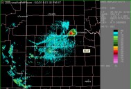
| Well, this supercell was certainly holding its own. We thought for a second that a line may have been trying to form. But, no such thing was occurring. In fact, storm splitting was occurring just before we left on the last image. Since the storm was moving so slowly, we had a chance at catching it. It's only about 2 hours to Altus, and then 25 more minutes to the Texas border. Here's some more images I saved during the same time period. |
 4:01pm storm relative velocity |
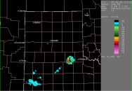 4:11pm VIL |
 4:06pm Storm Tops |
|
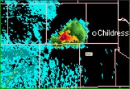
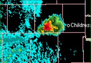
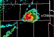
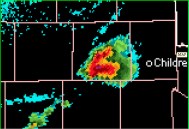
Since the storm had little if
any movement, we kept on thinking it was a right mover. However, I called
a friend at Channel 5 and I was told there was now a cluster of cells
centered over Childress, and nearly stationary. So, we continued west
on Highway 62 and headed towards Childress, TX.
|
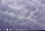
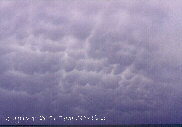
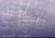
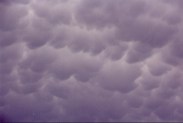
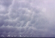
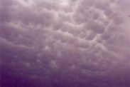
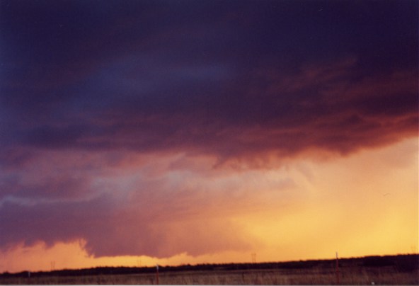
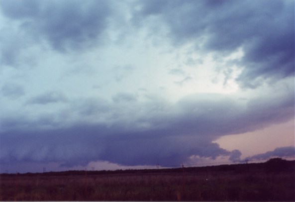
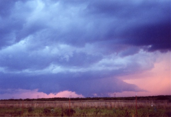
The mammatus were visible well before we reached the storm |
||||
|
|
|
||||
|
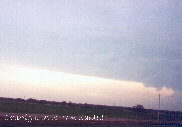
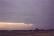
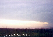
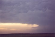
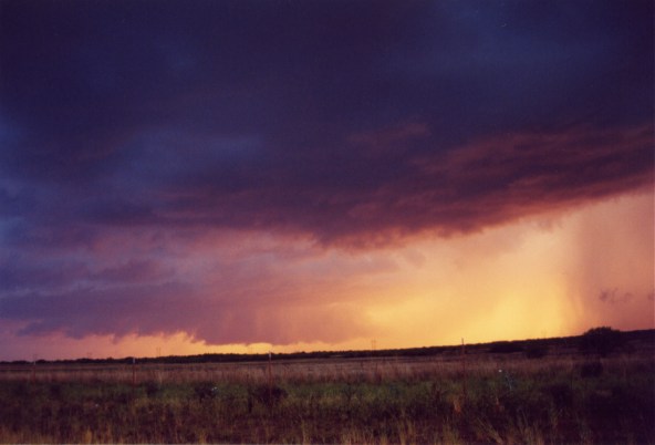
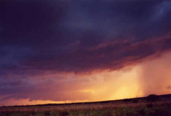
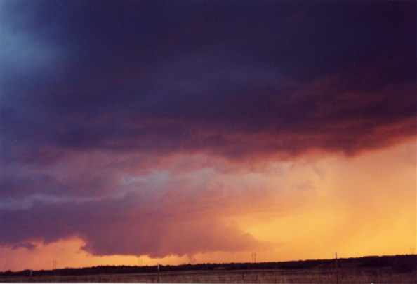
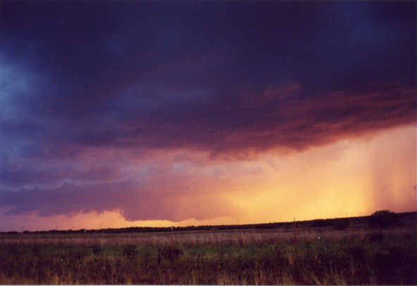
As the wall cloud got closer the, forward flank downdraft kicked into high gear and pushed a heavy rain shaft well ahead of the main part of the storm. So, we had to leave quite a few minutes before the wall cloud got really close. This may have been a good thing considering it was getting dark. But hey, when we finally decided to leave the storm it wasn't quite dark yet! |
What an amazing wall cloud |
||||
|
|
|
||||
Home | Storm Store | Photo Gallery | Message Board | Storm Chases | Latest News
Stock Footage | About | Contact | Editorial | Weather Links
Copyright 2001 Stormgasm.com. All rights reserved.