Borah Peak, Idaho: Part 1
August 12th - August 16th, 2008 Trip

|
August 12th, 2008 Simon and Anna, and their freinds Shawn and Brandon, toured the northern U.S. Rocky Mountains. The purpose of the trip was to successfully reach the top of Mount Borah, which is the tallest mountain/highest point in the State of Idaho at 12,662 feet. We then planned on doing some climbing/hiking in Grand Tetons National Park, then followed by some climbing in the Colorado Rockies. Trips don't always turn out as planned, this one was no different; we did reach the top of Mt. Borah, we did arrive in Grand Tetons Nat. Pk., but we didn't do anymore climbing past Mt. Borah. We decided to skip climbing in Colorado for a one-day sprint through Yellowstone National Park in northwestern Wyoming. Like always, the pictures don't do justice to these beautiful places, but it's fun to try. Comments written by Simon Brewer. |
|
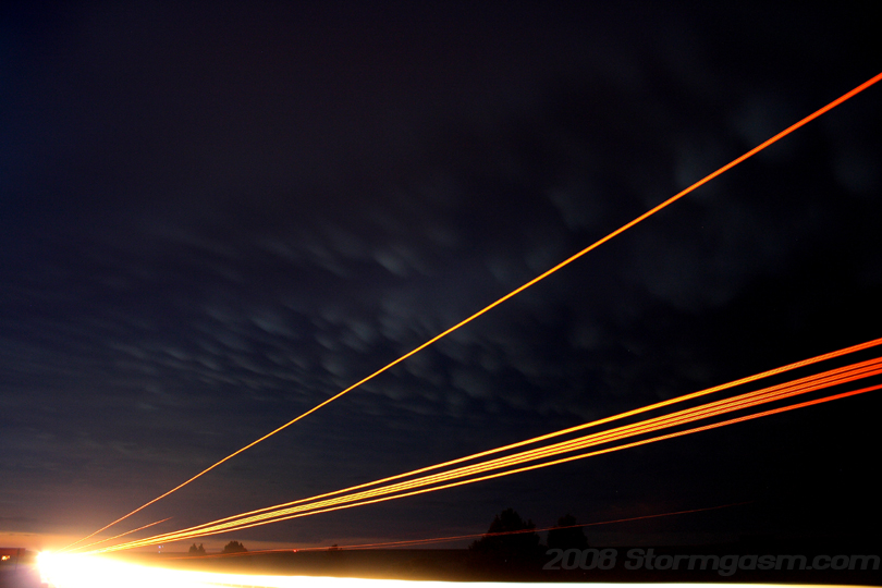
We (Anna, Brandon, and I, Simon) left Norman in the early morning hours on August 12th, 2008. We drove across northwest Oklahoma, through western Kansas, and past the plains of eastern Colorado; we picked up Shawn in Denver, CO after the sun had risen. The image on the right shows early morning mammatus over western Kansas from a nighttime thunderstorm over the CO/KS border. The beams of light are from car headlights passing through the long exposure of the camera. I had been planning this trip for a long time: Shawn got me interested in climbing the high points of the 50 States in the U.S.A. back in 2006. I had known about what they call 'high pointing', but wasn't too interested until Shawn lent me a book called, "To the Top". After reading that book I was determined to reach all 50 State high points. I've always been a big fan of hiking and climbing mountains, so reading about Mount Borah got me excited even if it were not a high point. I wanted to climb Borah Peak in 2007, but plans fell through, so I made it a mission to climb that mountain in 2008. I waited for the perfect weather patturn before heading on our trip; basically, a trough was moving across the Northern Rockies and would be replaced by a ridge for about 4 days. You want to climb mountains under a ridge, which means light winds, clear skies, and most importantly, a low chance for precipitation. We left Norman as the Trough was moving through, so we got a lightning show in Western Kansas, but the following days would be clear skies and perfectly calm weather. |
 |
|
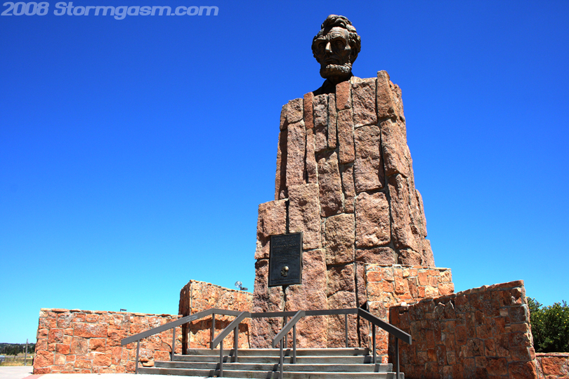
We took I-80 west from Cheyenne, WY after picking up Shawn in Denver, CO. Not long after Cheyenne we arrived at a rest area and I took the image on the right. This was a memorial for the 'Lincoln Highway', which was the first transcontinental highway in the United States; that was a huge Lincold head, which was, apparently, 13.5 feet in height! The rest area was very cool, and I recommend stopping there for a break from a long drive. I can't remember the elevation at the rest area, but it was pretty high; maybe over 8,000 feet. |
 |
|
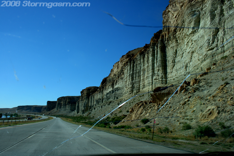
Image on the right shows a canyon wall along I-80 in southwestern Wyoming; this was a very cool area, but there was nowhere to pull over and take a better pic, so cracks in the window are in the image. Not long after I took this image distant snow-capped mountains in Utah were visible to the south where 'Kings Peak' is located, which is a future destination since it is the highest point in Utah. South-central Wyoming was desolate and dry; we drove through 'Great Divide Basin', which is a large region where water does not flow to any ocean, but is trapped. The water can only leave the basin by flowing underground or evaporation. The region is a desert, which probably explains why the basin does not fill to make a massive lake. |
 |
|
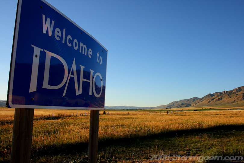
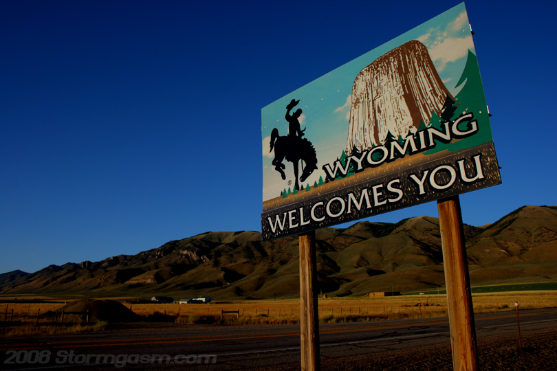
Image on the right shows the Idaho 'welcome' sign at the WY/ID border, and the next pic below on the right shows the Wyoming 'welcome' sign a few hundred feet away. We took S.R. 30 through southwestern Wyoming into southeastern Idaho. This region was beautiful; wheat fields surrounded by small mountain ranges. |
 |
|
Image on the right shows the Wyoming 'welcome' sign. We stopped in a small town in Idaho and ate some tasty buffalo burgers for dinner. I think the name of the town was Montpelier... |
 |
|
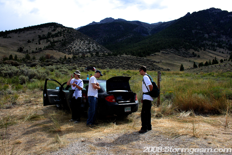
We drove into the night and reached the Lost River Range, where Borah Peak is located after midnight. We reached the campground at the base of Borah Peak around 2 or 3 am. It was chilly, but not too bad. We set up our tents, except Shawn who slept in the car, and tried to sleep. I was exhasted from a day and a half of driving, but I was extremely excited, so i didn't pass out immediately. We woke late the next morning and were not ready to start the climb until 10 or 11 am (MDT). If the region was not under strong subsidence from the ridge then I would have waited one more day to climb Borah. I knew we might get a sprinkle from some lingering mid-level clounds, but a T-storm was out of the question, so we decided to make an attempt at the summit. Image on the right shows Anna, Shawn, and Brandon preparing for our trip up the mountain; gathering water, food, clothing and supplies we might need climbing Borah Peak. Borah Peak can be seen in the background. |
 |
|
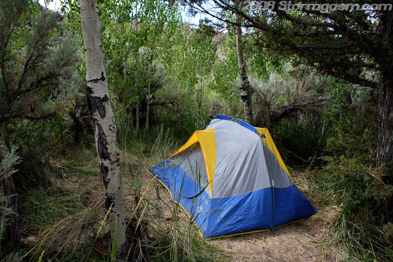
Image on the right shows one of our tents on the campground at the base of the mountain. |
 |
|
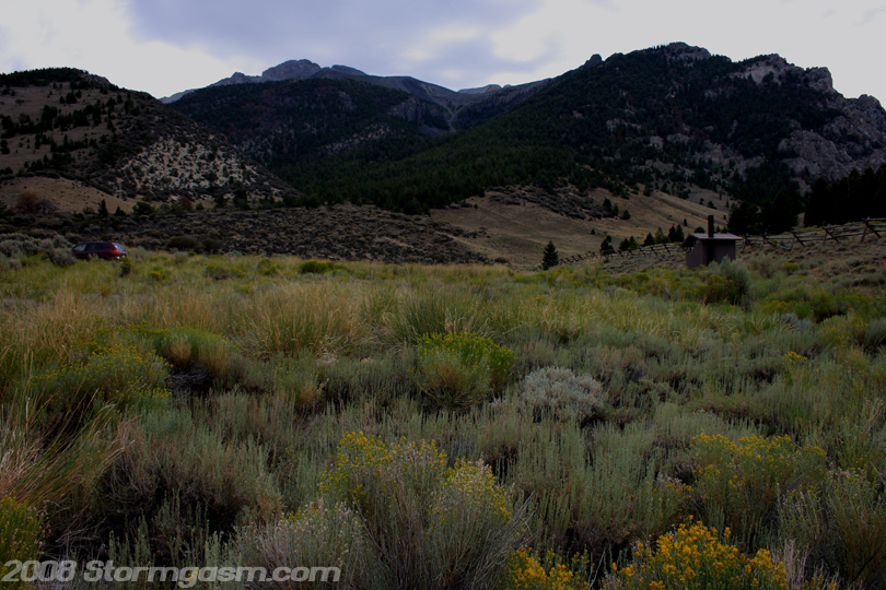
Image on the right shows our goal; Borah Peak looming in the distance. The parking lot and a bathroom at the trailhead can be seen in the foreground. Our only concern about starting the climb so late was that we might be caught going down the mountain at night, which ended up happening. |
 |
|
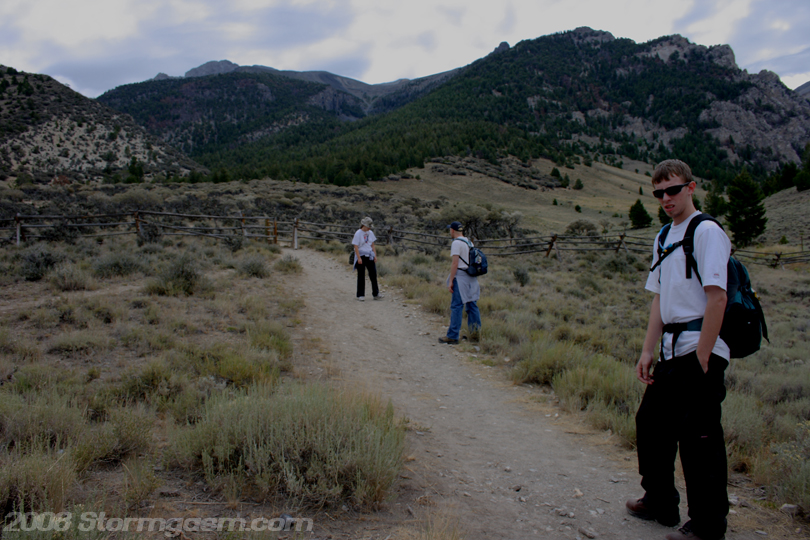
The image on the right shows the begining of our journey at the Borah Peak trailhead; I took the picture, Brandon is closest to me, then Shawn, and Anna is furthest up the trail. I ran distance most of my life and ran for a division one collegiate cross country and track team, so at the time we began climbing Borah Peak I was in good shape compared to most people, but bad shape compared to my past. Brandon was in good shape and had been exposed to long back-packing trips in his past. Anna was not in the best shape and I didn't know Shawn's shape, but he had been doing some hiking in Colorado before the trip, so he should have been accustomed to higher altitude more than anyone in the group. What ended happening was Brandon and I quickly broke away from Shawn and Anna, because we both had a pretty big stride and felt good. Before long we were breaking through the trees and above the timberline. |
 |
|
Pic on the right shows part of the beginning of the trail that cuts through a forest. The trail can be seen below in the trees. Shawn, Brandon, Anna, and I had started the climb together, but not long after entering the forest Brandon and I pulled away from Anna and Shawn. Brandon and I were making great time and before we knew it were pushing for the treeline. |
 |
|
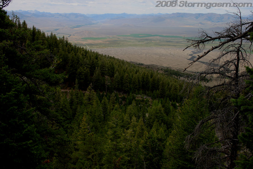
Pic on the right shows the trail after we emerged above the timberline. The trail can be seen leading to what is known as "Chicken-out Ridge", which is apparently a part of the trail where people who don't feel up for the rest of the climb stop the climb. It's hard to explain how cool it is to be above the treeline/timberline. There is an almost unobstructed view of the surrounding environment. I felt like I was truely free up there in the mountains away from most of civilization. |
 |
|
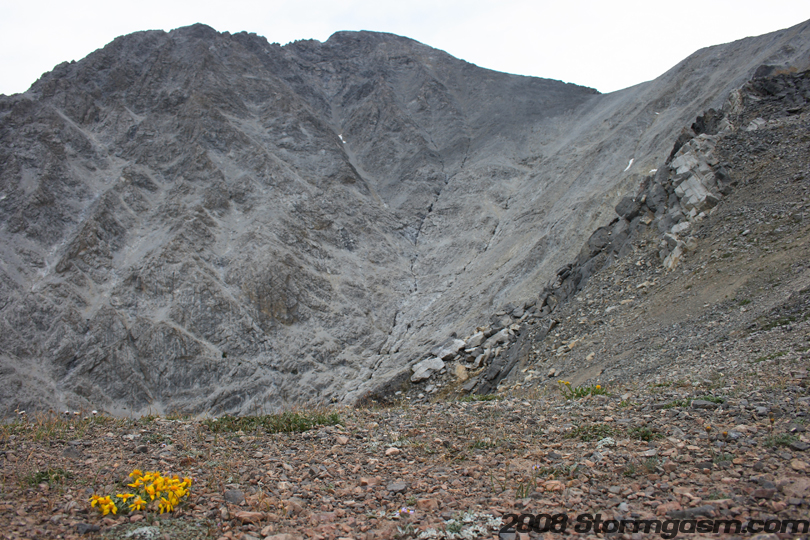
The image on the right shows yours truely getting his first close-up view of Borah Peak. I was standing on the edge of a large ridge on the southwest side of the mountain. Between my location and the peak was a massive gully/ravine. The oragne thing in my hand was a rain poncho; we had some sprinkles near the timberline. |
 |
|
The
image on the right shows our first close-up view of Borah Peak from
the southwest ridge with some alpine flowers in the foreground.
|
 |
|
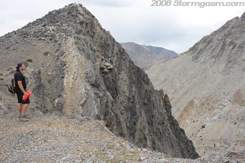
Image on the right shows Brandon staring into the massive ravine between the peak and the southwest ridge. |
 |
|
I had the camera, so I would plow ahead and try to get shots of Brandon on the mountain for depth, to show how high we were and to give a sense of the size of the mountain. The image on the right shows Brandon marching onward up the long southwest ridge of Borah. |
 |
|
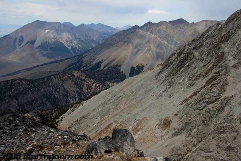
Image on the right is looking SSE at a neighboring mountian. There were awesome views, which only got better the further we climbed. |
 |
|
Image on the right shows the Lost River Range trailing to the north of Borah Peak. |
 |
|
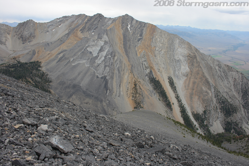
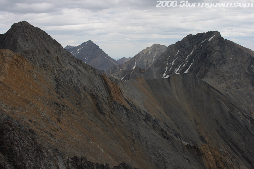
Image on the right shows more peaks in the Lost River Range to our southeast; I think the furthest peak on the left of the image might be Leatherman Peak. |
 |
|
Image on the righat shows Brandon continuing up the ridge. shortly after the pic was taken we got to the ridge known as 'Chicken Out Ridge'. |
 |
|
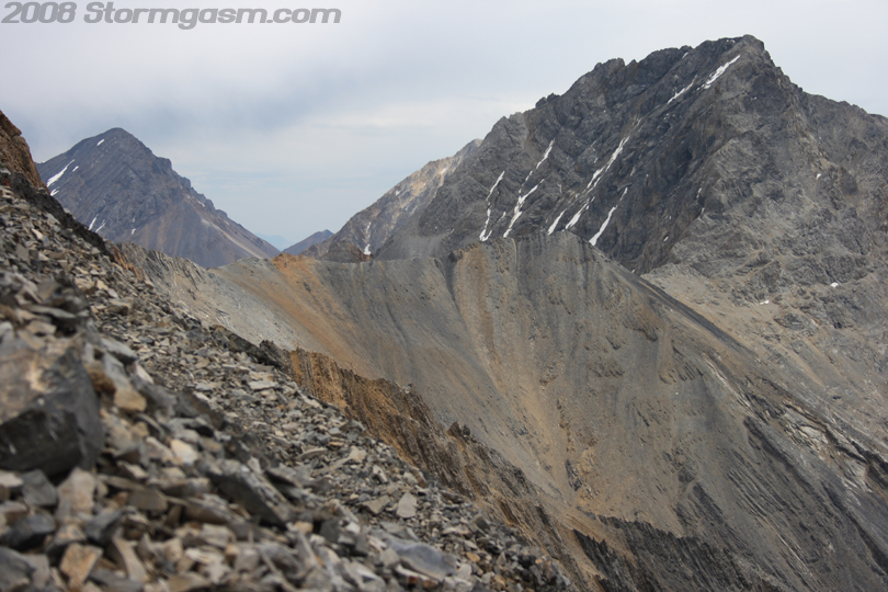
Image on the right shows our view to the southeast of other mountain peaks. |
 |
|
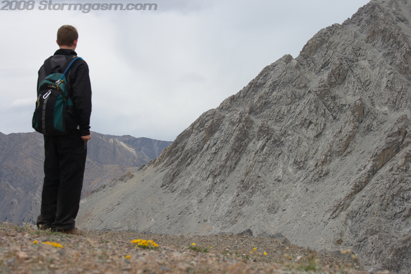
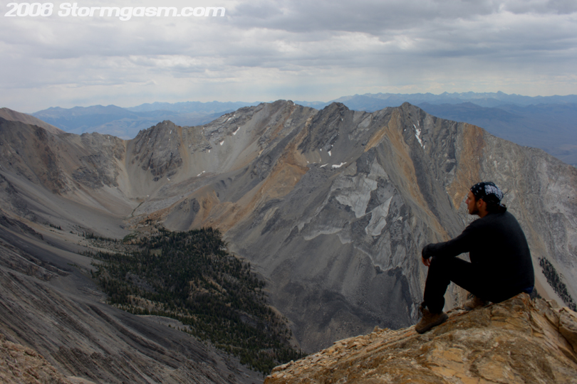
Brandon and I reached the bottom of 'Chicken Out Ridge' and got a message from Shawn over the walkie-talkie to wait there for Anna and Shawn, so we took a break. Image on the right shows Simon looking for answers to the toughest life questions... |
 |
|
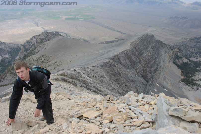
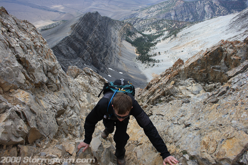
Brandon and I were getting cold waiting for Anna and Shawn, so we climbed further up the ridge to find a notch in the rocks to shelter us from the wind. The image on the right shows Brandon climbing. |
 |
|
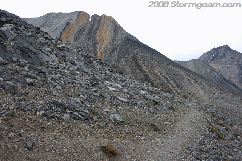
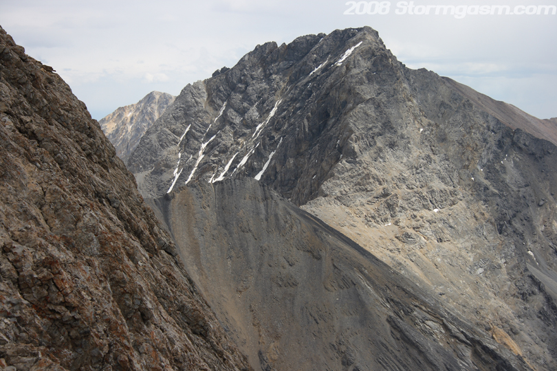
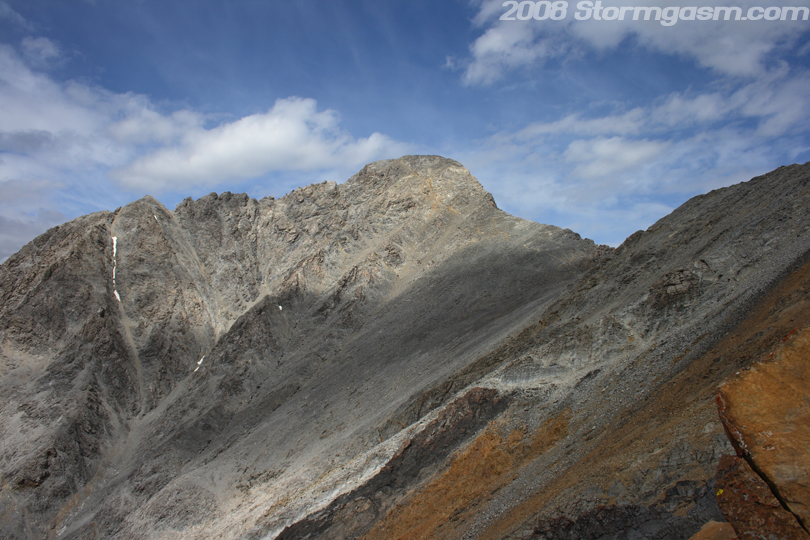
Image on the right shows our view of Borah Peak from the beginning of 'Chicken Out Ridge'. |
 |
|
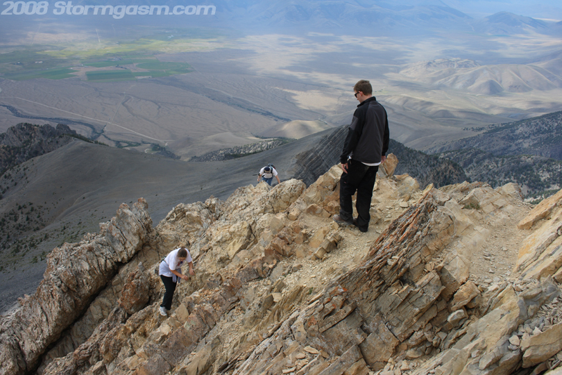
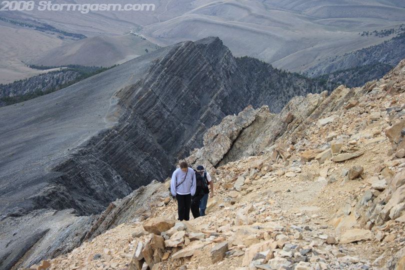
Image on the right shows Anna and Shawn as they caught up to Brandon and I on the ridge. |
 |
|
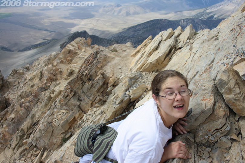
Image on the right shows Anna exhausted from the long climb up Borah. Anna and Shawn took a break. Anna was not feeling well, probably from dehydration or elevation, so she stayed behind. Shawn, Brandon, and I made then climbe across 'Chicken Out Ridge' and made the final push for the summit. |
 |
|
Image on the right shows Anna and Shawn climbing further up the ridge before we left Anna. |
 |
|
Image on the right shows our view of peaks in the Lost River Range to our southeast.
|
 |
Home
| Storm Store | Photo
Gallery | Message
Board | Storm Chases | Latest
News
Stock Footage | About
| Contact | Editorial
| Weather Links
Copyright 2004 Stormgasm.com. All rights reserved.