June 6th, 2007
South Dakota Tornado
|
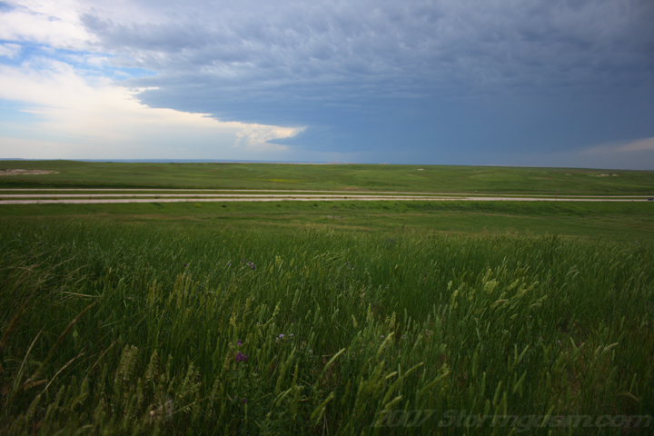
Simon Brewer and Anna Morrell documented a beautiful LP-Supercell and Tornado in Southwestern South Dakota. Target was SW/Central South Dakota; expected storms to fire off of dryline/surface trough or even upslope in response to shortwave trough moving through the central/northern Rockies. First pic is on SR 73 a few miles south of Kadoka, SD looking north.
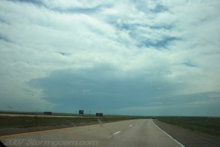
This pic shows an exploding tower (shadow on midlevel clouds) to the southwest of Kadoka, which eventually became a tornadic supercell.
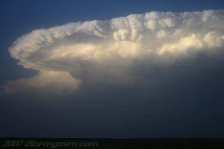
The same tower from above, but now it is much bigger and was probably an LP supercell at this point; pic looking wsw on I-90 west of Kadoka, SD.
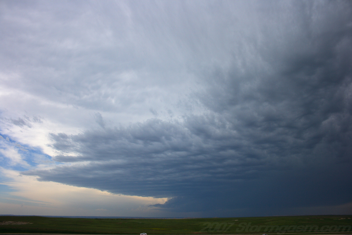
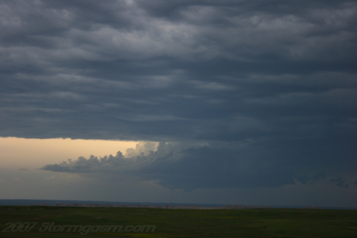
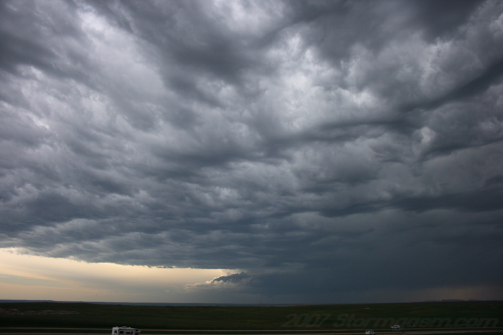
This pic is from a pull-off overlook on I-90 between Kadoka and Cactus Flat. That supercell is about 35 to 40 miles away! I decided to stay at this vantage point, because I figured the supercell would propagate to the northeast toward my location.
Same spot, but it appeared the supercell was nearly stationary and I was worried it would produce well before reaching my location.
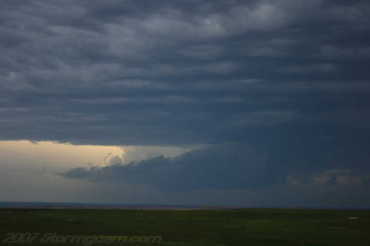
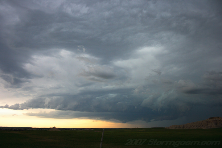
The supercell was getting very well organized with a high-based wall cloud and a nice tail cloud. It was very LP at this point, but looked really good on radar. I knew at this point it would produce soon and very far from my location, but I didn't want to risk missing the tornado by changing locations, so I remained on the overlook.
A few groups of storm chasers began pulling up to the overlook, so it was becoming crouded, which added to my frustration; being so far away from the supercell.
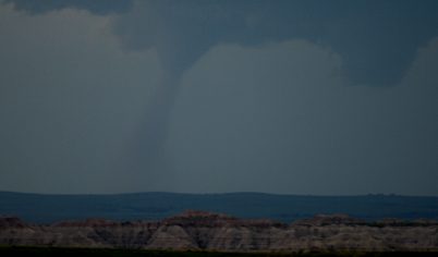
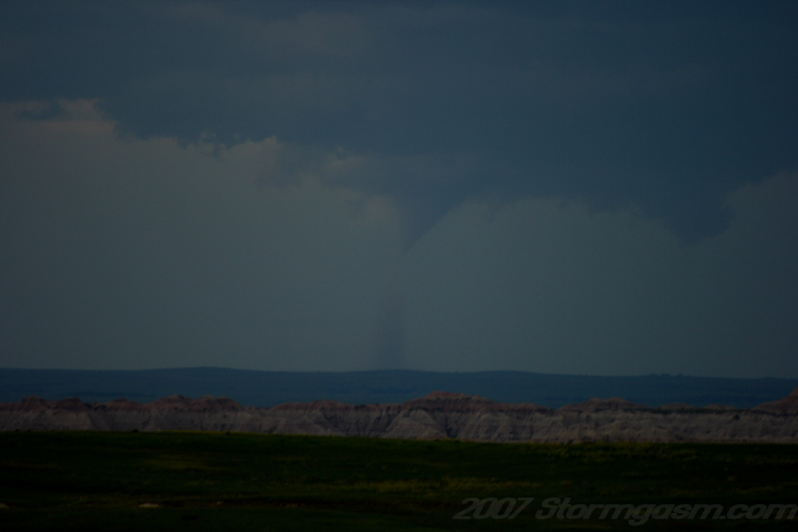
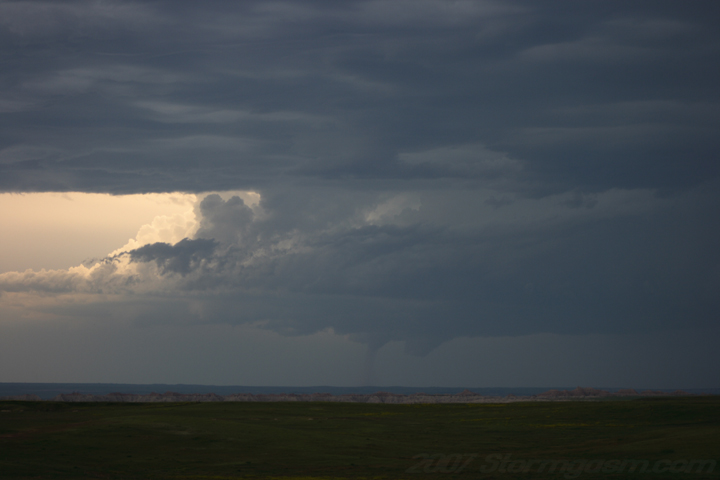
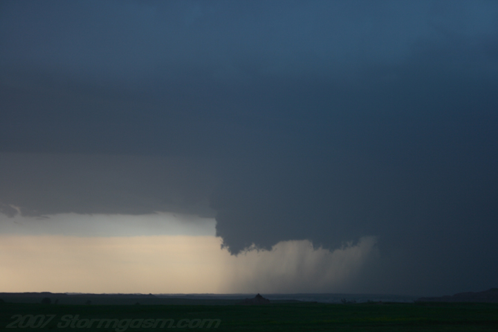
Tornado is on the ground in this pic...once again; I was maybe 35-40 miles away, frustration! But the supercell was a beautiful LP!
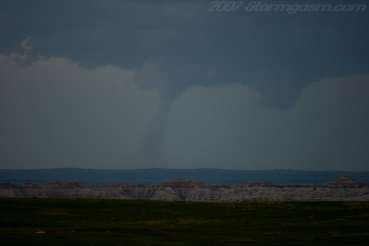
Zoomed in on the tornado.
Tornado was on the ground for quite a long time; maybe 30 minutes plus?
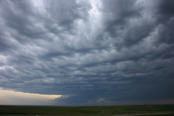
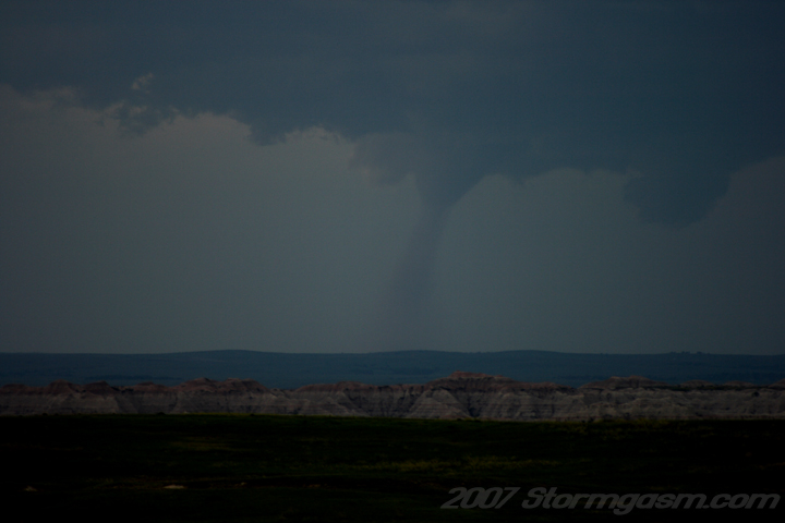
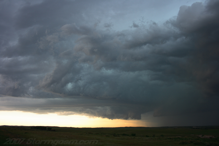
Tornado was still on the ground in this pic, but I wanted a nice wide shot of these cool mid-level clouds ahead of the updraft. We left the overlook after this pic; wanted to get closer to the updraft for future tornadoes since it appeared the storm was barely moving, despite the fact this tornado was still on the ground.
Same storm, but south of the small town of Interior,SD.
This was the last chance I think the storm had to produce another tornado, but there was a black rain core to the west of the updraft and I knew the storm was going to become outflow dominant if not already undercut.
Elevated wall cloud/bulbous shelf cloud. The cell became a monster bow-echo/HP-beast, which pounded me with some insane winds on I-90 west of Kadoka when I was foolishly punching the core.
A linear cell, which fired of a sfc trough later in the evening northeast of Chamberlin, SD.
|
|
Home
| Storm Store | Photo
Gallery | Message
Board | Storm Chases | Latest
News
Stock Footage | About
| Contact | Editorial
| Weather Links
Copyright 2004 Stormgasm.com. All rights reserved.