June 17, 2009 Aurora, NE Tornado Outbreak
As Seen on
![]() on The Weather
Channel
on The Weather
Channel 
|
June 17, 2009: Simon Brewer and Juston Drake documented 7 tornadoes between Grand Island and Aurora, NE. Report: Supercell thunderstorms developed early in the afternoon across Southeast Nebraska and moved into Northeast Kansas. Simon and Juston jumped on two of the supercells near the KS/NE border. A few tornadoes had been reported on the first supercell before Juston and Simon could intercept. The supercell had great structure, but was outflow dominant, so the chasers drove northeast to their main target for the day, Southcentral Nebraska.
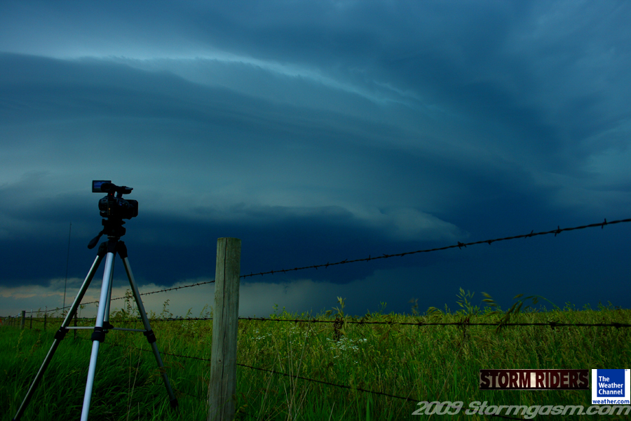
The image on the right is a pic of a camcorder in getting a timelapse of the first supercell of the day in Northeast Kansas. |
 |
|
The supercell had great structure, but was outflow dominant, so the chasers drove northeast to their main target for the day, Southcentral Nebraska.
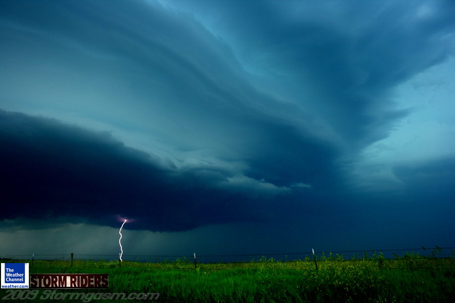
The image on the right is a picture looking northwest at a striated supercell updraft with an lightning bolt under the base in Northwest Kansas. |
 |
|
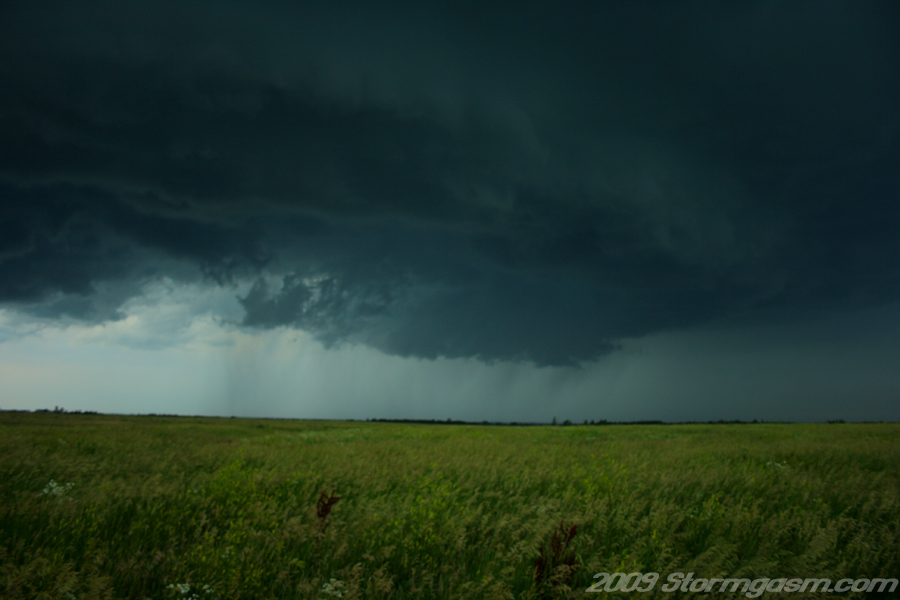
The image on the right is a picture looking northwest at a wall cloud undercut by cool outflow from a supercell in Northwest Kansas. |
 |
|
The
chasers approached developing cumulous towers near the Nebraska/Kansas
border, but decided to continue northeast to the main target of the day
near Kearny, NE.
The image on the right is a picture looking west-southwest at a developing cumulus tower in Northeast Kansas. |
 |
|
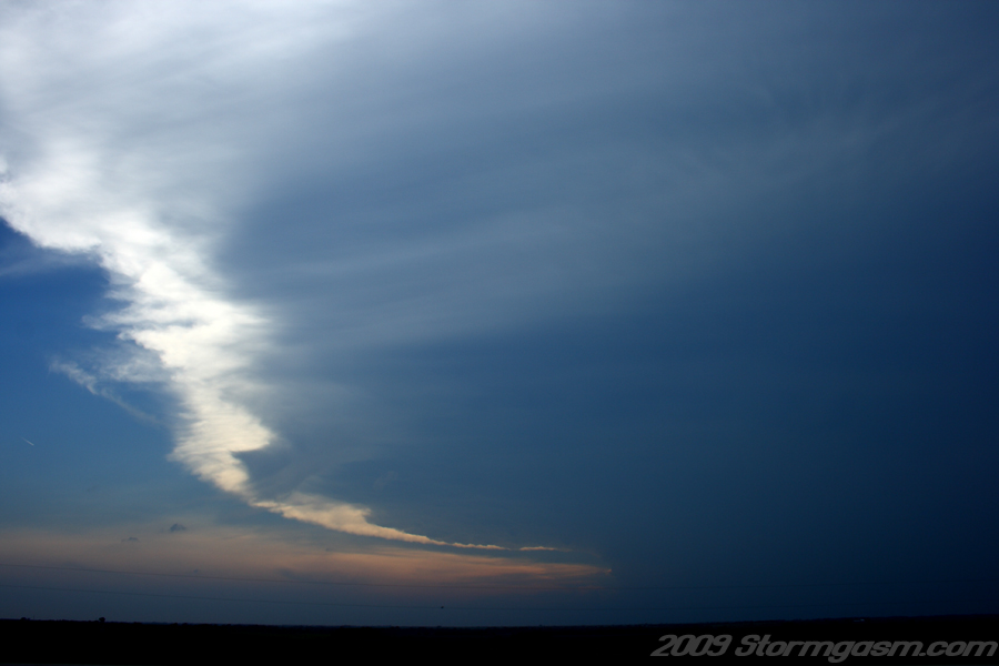
The chasers continued north into Nebraska and quickly leaned a storm was developing in their target location (the target is a region where the chasers are forecasting the best storms of the day to develop). The storm developed so quickly Simon and Juston could already see the strom's anvil from their location.
The image on the right is a picture looking west at a supercell anvil west of Grand Island, NE; the photographers/chasers were south of York, NE at the time the photo was taken. |
 |
|
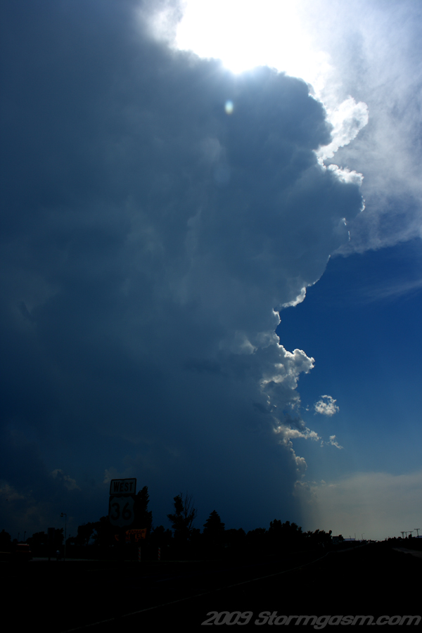
The chasers reached York, NE and turned west toward the intensifying supercell. The sun was blocked by the supercell updraft showing the chasers the storms profile.
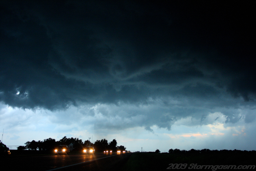
The image on the right is a picture looking west on Interstate 80 southeast of Grand Island, NE showing the backlit profile of a supercell updraft, flanking line, and anvil in the distance. |
 |
|
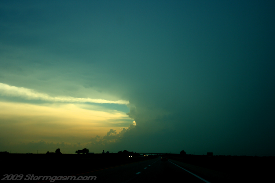
The chasers heard reports of tornadoes spotted by chasers over the radio. The report stung like a knife to Simon and Juston, because most storms the chasers had intercepted that year only produced one tornado, so they thought they may have missed the main tornado of the day. Still determined to intercept the storm the chasers drove onward hoping the storm would be cyclic and produce more tornadoes.
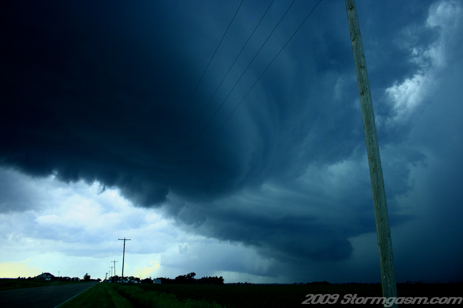
The image on the right is a picture looking west at supercell structure west of Grand Island, NE; the new mesocyclone can be seen over the road with an older occluded meso in the distance to the right of the road. |
 |
|
The chasers drove north from I-80 and then west on farm roads and approached the storm from the east. Simon and Juston were greeted with an amazing display of occluded mesocyclones. The storm was definitely cyclic (a cyclic supercell will produce multiple mesocylones each occluding and dying, while a new one forms). A cyclic supercell is more likely to produce multiple tornadoes, so the chasers were happy, but the storms newest mesocyclone was looking very poor at that time.
The image on the right is a picture looking west at three mesocyclones lined in a row from a single supercell west of Grand Island, NE; two mesocyclones in the background were completely occluded and the newest meso in the foreground is over the road. |
 |
|
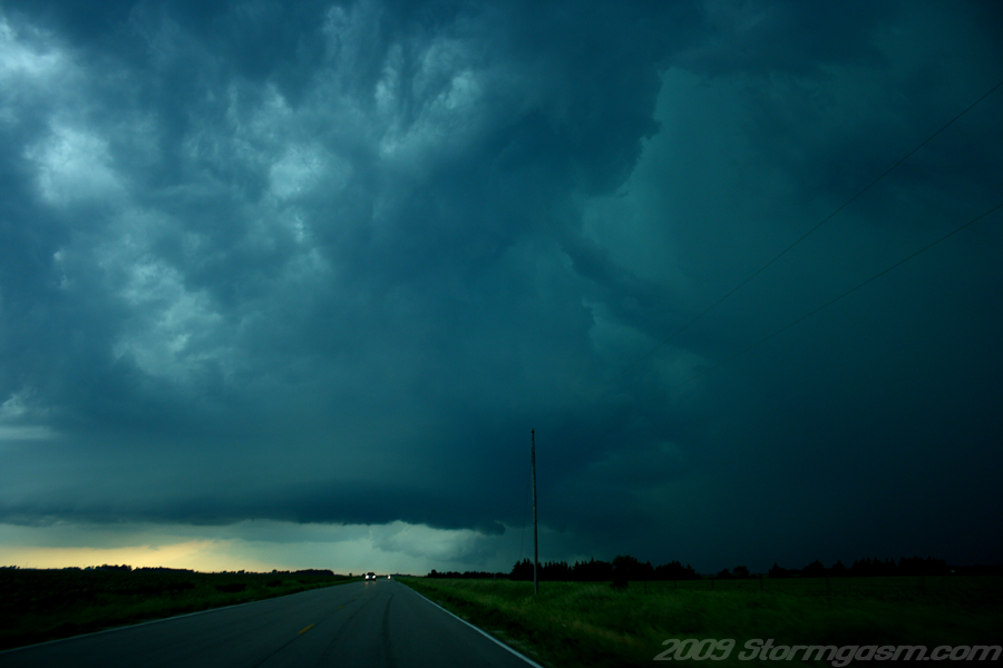
The chasers witnessed the storm struggle to survive as it appeared less intense on radar and visually, but then as quickly as it had weakened it developed a well-shapped wall cloud. A very well-defined tail cloud had begun to feed the new wall cloud.
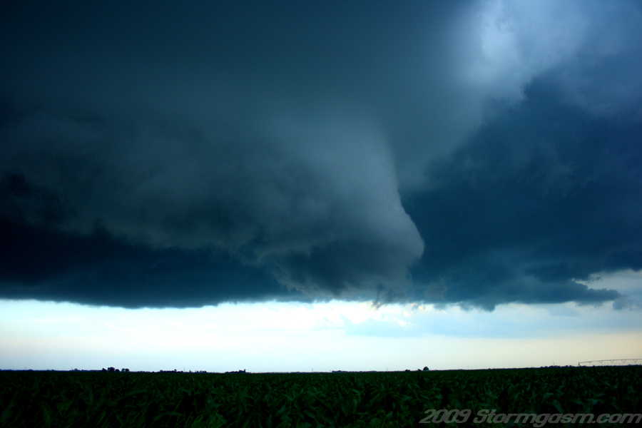
The image on the right is a picture looking east at a well-defined tail cloud feeding north to south into the new wall cloud on the supercell west of Grand Island, NE. |
 |
|
The chasers were happy to see the new rotating wall cloud; during storm chases Simon and Juston experience multiple ups and downs associated with their excitement driven by both atmospheric beauty and meteorological experience.
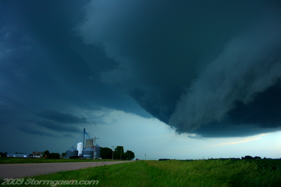
The image on the right is a picture looking southeast at a well developed rotating wall cloud west of Grand Island, NE. |
 |
|
Simon and Juston drove east barely skirting the north side of the ominous mesocylcone. They spotted a small cone funnel to their south, which did not become a tornado, but a small short-lived tornado did, eventually, develop to their east-southeast. That tornado was the first of many for the chasers that day. At this time Juston and Simon were in awe of the incredible structure the storm displayed.
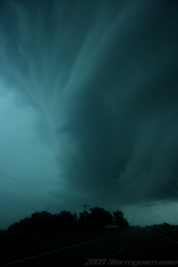
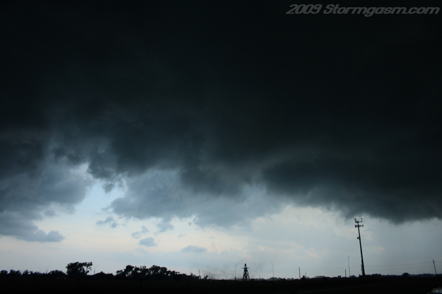
The image on the right is a picture looking east at the north side of the monster supercell; the north side of the mesocyclone with striations, the tail cloud, and vault are visible. |
 |
|
Simon and Juston raced east of the maturing mesocyclone parking on the south side of Grand Island, NE. Rapid rotation developed at the base of new occluding mesocyclone; it appeared likely a second tornado would form to the southwest of the chasers. Just as Simon and Juston thought their second tornado quickly developed in a small field to the southwest. The tornado moved through a grove of large trees lofting leaves and branches into the air.
The image on the right is a pic of the second tornado on the south side of Grand Island, NE; a bowl-shaped funnel can be seen with debris underneath immediately to the right of the trees and behind the small wooden windmill tower, which lacked blades. |
 |
|
The tornado did not last long, but the chasers did have to reposition before the tornado passed over their location; debris rained from the sky as the tornado crossed the road to their east. The tornado touched down intermittently to their northeast as they drove east to reposition. Tornado 2 eventually dissipated and a new anticyclonic funnel cloud (rotation in is clockwise instead of the more common counter clockwise rotation seen in the Northern Hemisphere) under the rear flank downdraft gustfront was spotted to their south as they attempted to get east of a newly developing mesocyclone. Soon debris was spotted by Juston under the anticyclonic funnel cloud giving the chasers tornado number 3 for the day. The anticyclonic (landspout type) tornado did not last long and the new mesocyclone, now west of the chasers, was rapidly rotating with curling rope/cone funnel cloud over the road. Debris (dust, dirt, and leaves) was tossed into the air and tornado number 4 had developed to the west of the chasers.
The image on the right is a picture looking west at tornado number 4 (debris can be seen behind the trees left of the road). |
 |
|
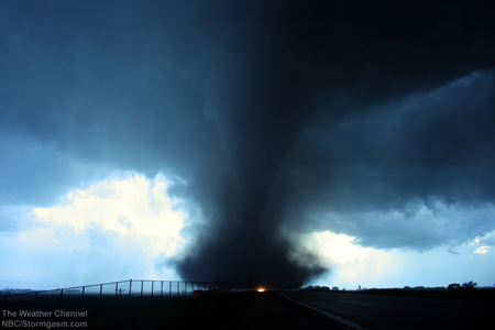
Simon and Juston are very excited as the 4th tornado intesified to their west; multiple vorticies were witnessed with the tornado as a small cone condensation funnel grew in size above the growing debris cloud. The funnel soon became large; the tornado took the appearance of a large cone/bowl-shaped funnel with a large debris cloud. The condensation funnel may have been a cone in appearance, but the true cylindrical shape of the tornado vortex could be seen from the debris cloud.
The image on the right is a picture looking west at tornado number 4 as it intensifies south of the road. The tornado had a cone/bowl-shaped funnel with debris underneath appearance. The RFD (rear flank downdraft) clear slot can be clearly seen in the photo to the left of the tornado. |
 |
|
The image on the right is a picture looking west at tornado number 4. |
 |
|
The image on the right is a picture looking west at tornado number 4. |
 |
|
The image on the right is a picture looking west at tornado number 4. |
 |
|
The tornado tracked east paralleling the road, but to the south of the road. The tornado appeared to be relatively large at this point: maybe 200 meters wide or more. The chasers continued east staying slightly ahead of the tornado. While the chasers were driving east staying ahead of the main tornado another smaller tornadic circulation developed in close proximity to Simon and Juston; this circulation was short-lived tornado number 5.
The image on the right is a picture looking west at tornado number 4 in the background with Juston and the car in the foreground. |
 |
|
The tornado began to weaken slightly and become obscured in a large amount of dirt that had been pulled high into the sky up to the base of the storm masking the condensation funnel of the tornado. The tornado now had a large dusty stovepipe appearance.
The image on the right is a picture looking west at tornado number 4. |
 |
|
The image on the right is a picture looking west at tornado number 4, which appeared as a "dusty stovepipe". |
 |
|
The image on the right is a picture looking west at tornado number 4, which appeared as a "dusty stovepipe". |
 |
|
The chasers passed a farm (house, large barn, and outbuildings) to the south of the road as they repositioned east of the tornado. The farm was in the path of the large tornado; it received EF2 damage as the tornado passed over. Almost a month later the chasers and their producer passed the same location inspecting what they could of the damage path from the tornado. Most debris had been moved, power poles replaced, but the crops showed evidence a disaster had struck the area. As Simon, Juston, and their producer, Erin, neared the farm the owners, a wonderful, lively elderly couple, arrived and spoke to the group for nearly an hour about the tornado and the history of the farm. The wife had been born on the farm, which was seen as a local landmark of historic and personal significance. They gave Simon, Juston, and Erin permission to inspect the remains of the house, barn, and outbuildings (the entire property).
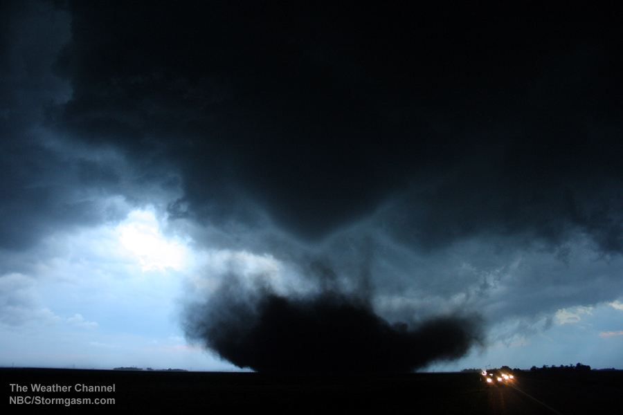
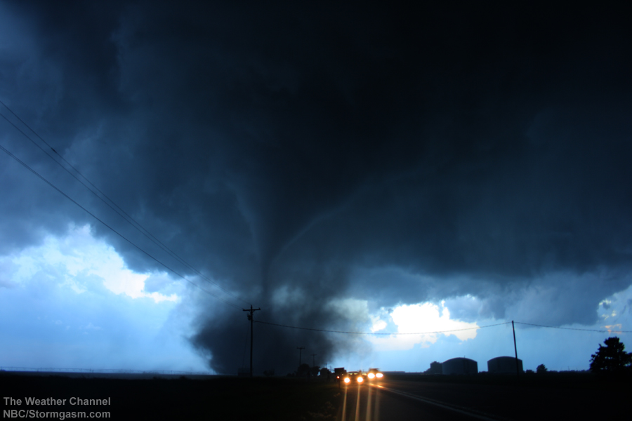
The image on the right is a picture looking west at tornado number 4 as it bears down on a farm west of Aurora, NE (the barn and trees surrounding the farm house are visible to the left of the road). |
 |
|
The image on the right is a picture looking west at tornado number 4 as it bears down on a farm west of Aurora, NE (the barn and trees surrounding the farm house are visible to the left of the road). |
 |
|
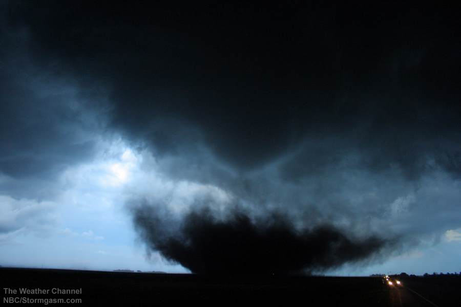
The image on the right is a picture looking west at tornado number 4 as it bears down on a farm west of Aurora, NE (the barn and trees surrounding the farm house are visible to the left of the road). |
 |
|
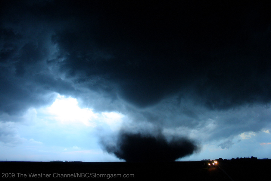
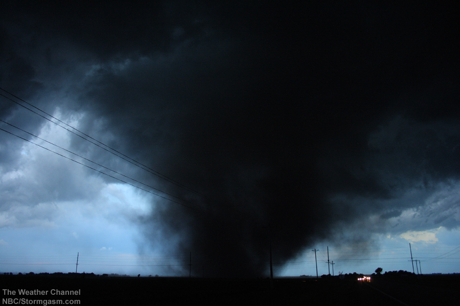
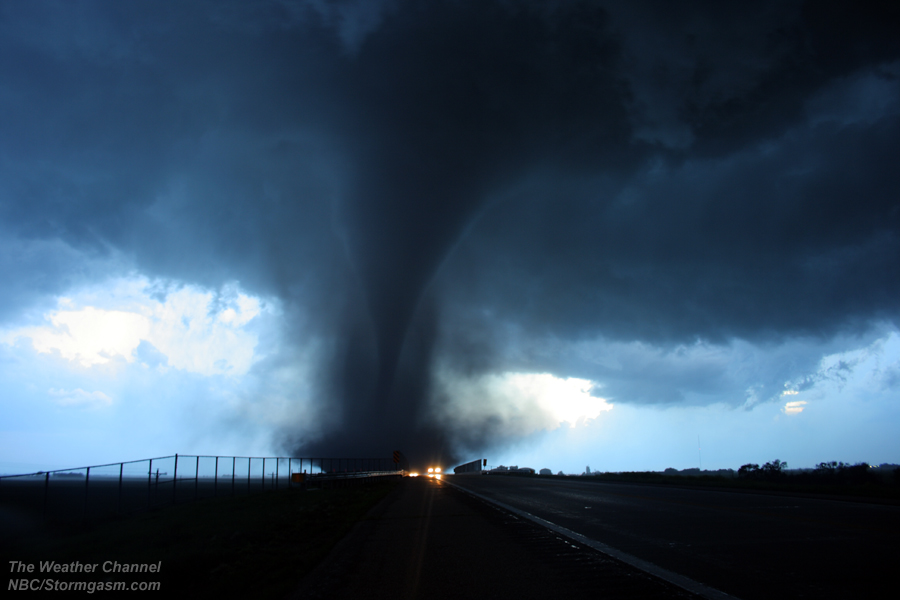
The tornado propagated closer to the chasers forcing them to move again; they repositioned on the east side of a large bridge, which crossed railroad tracks. The tornado had lost its 'dusty stovepipe' appearance and now had a fully developed cone condensation funnel, which disappeared near ground in a large debris cloud.
The image on the right is a picture looking west at tornado number 4 west of Aurora, NE.
|
 |
|
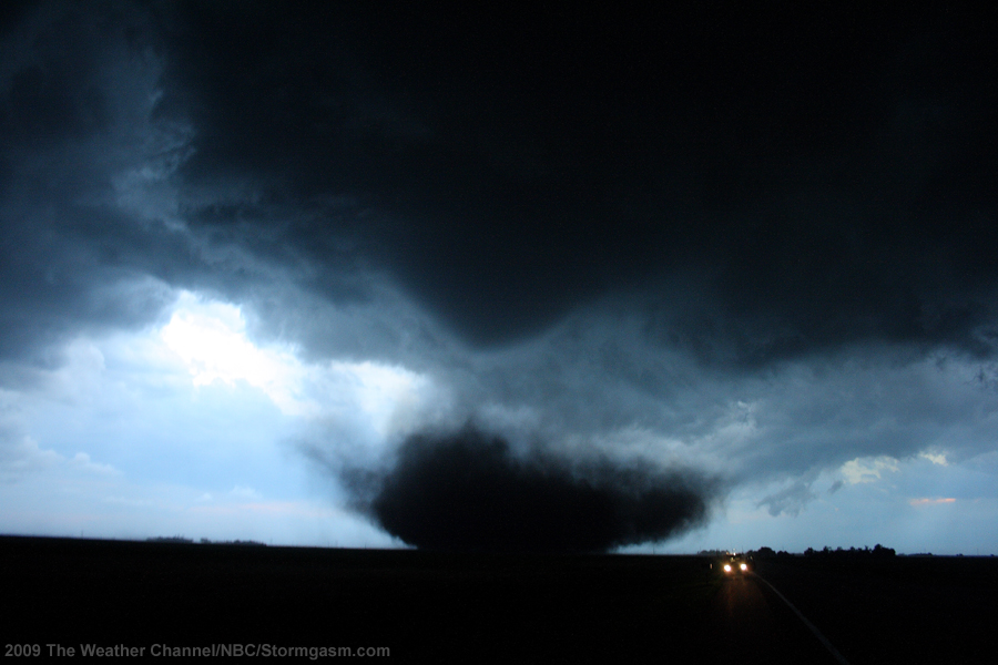
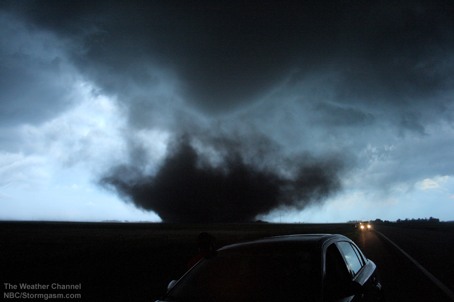
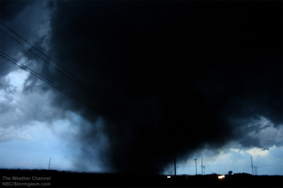
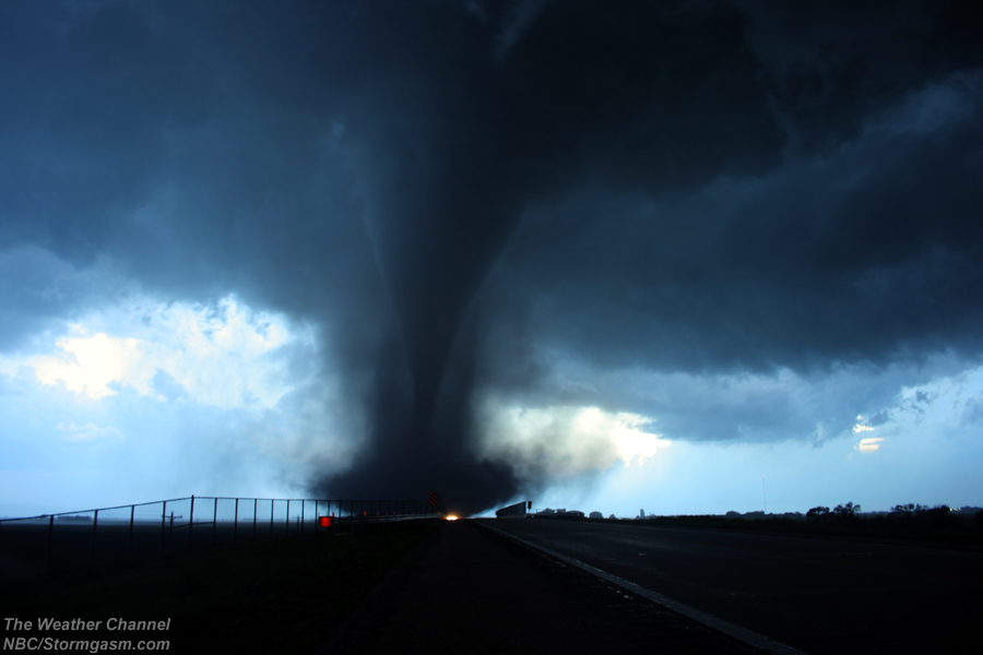
The image on the right is a picture looking west at tornado number 4 west of Aurora, NE. |
 |
|
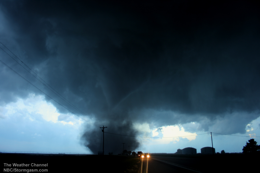
The image on the right is a picture looking west at tornado number 4 west of Aurora, NE. |
 |
|
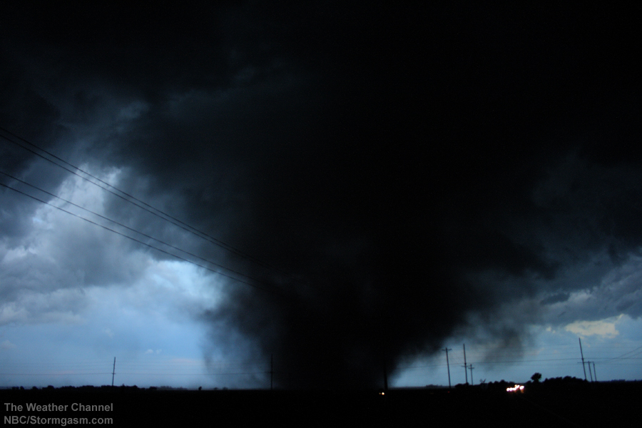
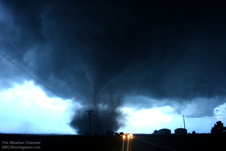
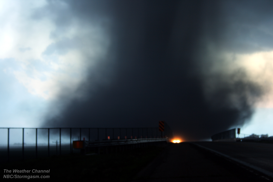
The image on the right is a picture looking west at tornado number 4 west of Aurora, NE; the picture is full size and a little blurry from the longer exposure (due to the waning light and zooming in on the debris cloud) combined with small vibrations from the high inflow winds going towards the tornado. The dark outline of the condensation funnel in the debris cloud can be seen in the photo. |
 |
|
The tornado had become large and from appeared visually to be at its strongest just west of Aurora, NE. The sun had set (or was in the process of setting) and the light was fading quickly. The tornado had made a turn to the north signaling its parent mesocyclone had been completely occluded. The tornado transitioned into a rather robust stovepipe appearance and quickly roped-out as the chasers attempted to reposition on the east side of Aurora. Tornado number 6 quickly developed around this time east of Aurora under a rapidly intensifying mesocyclone. Tornado number 4 was being obscurred by rain when tornado number 6 quickly developed and dissipated south of the chasers (about 50 meters south of the chasers).
The image on the right is a picture looking west at tornado number 4 west of Aurora, NE. |
 |
|
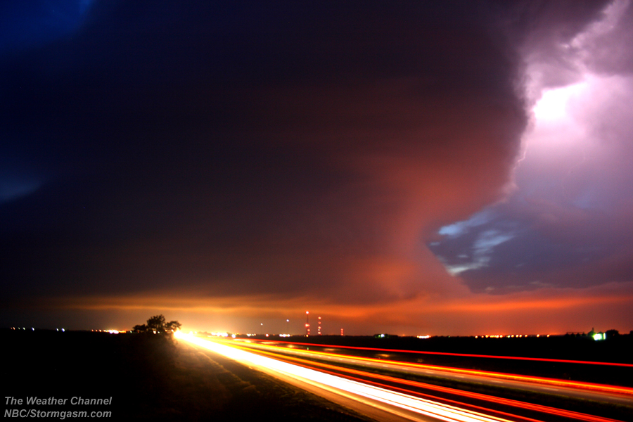
The chasers had seen 6 tornadoes from this storm; it was an amazing day for Simon and Juston. The chasers did not quit after dark; they drove east of the storm and captured some structure and lightning photographs as the storm continued eastward into the night.
The image on the right is a picture looking west at the tornadic supercell over York, NE. |
 |
|
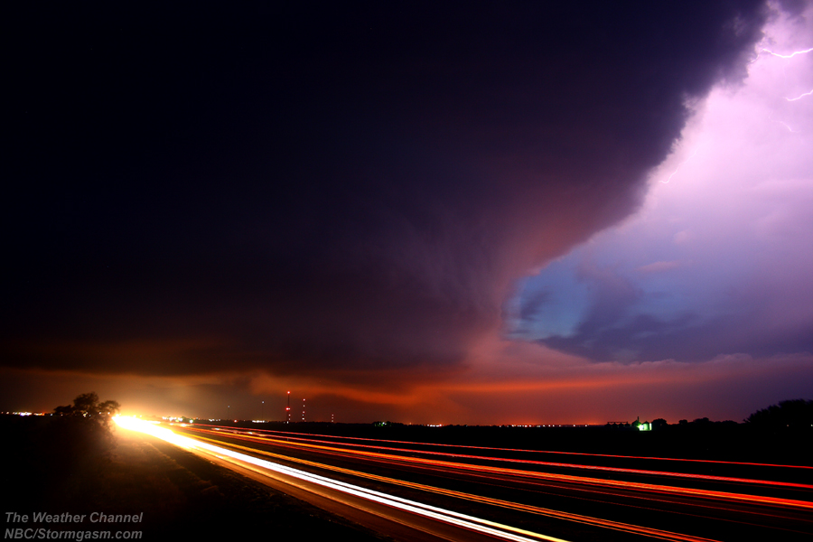
The image on the right is a picture looking west at the tornadic supercell over York, NE. |
 |
|
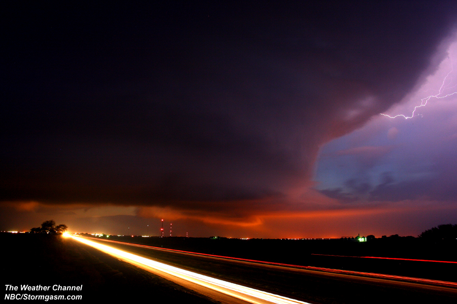
The image on the right is a picture looking west at the tornadic supercell over York, NE (the beams of light are cars driving along I-80 toward and away from York. |
 |
Home
| Storm
Store | Photo
Gallery | Stormtalk | Storm
Chases | Latest
News
Stock
Footage | About
| Contact
| Editorial
| Weather
Links
Copyright 2004 Stormgasm.com. All rights reserved.