March 7, 2009 Central Kansas Tornado
|
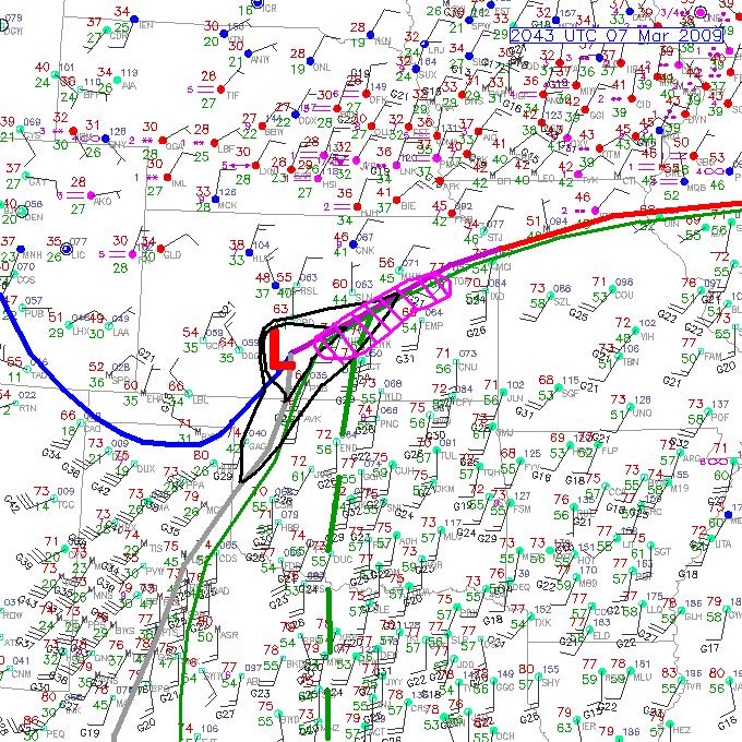
March 7, 2009: Simon intercepted a tornadic supercell and tornado in Central Kansas. This particular setup did not appear promissing for tornadoes, in my opinion, until the early morning of March 7th. I was tired from hiking Palo Duro Canyon, TX and chasing a high based LP supercell in the eastern Texas Panhandle the previous day/night. I woke early, poured over the data, made a solid forecast and left for work around 8am. I left work early by 1pm and hauled it to my target area around McPherson, KS. Image on the right shows a post analysis of the surface map at 2043 UTC: cold front (blue), stationary boundary (purple), warm front (red line), dryline (gray line), 50+ deg F dewpoints (thin green line), moisture axis (thick green dashed line), 2-surface pressure contours to show elongated surface low (thin black lines), and the surface low pressure center (red 'L'). The pink hatched region was my original target location from 7:30am, which, I have to admit, was pretty good for 8 hours or so in advance of the severe weather outbreak. |
 |
|
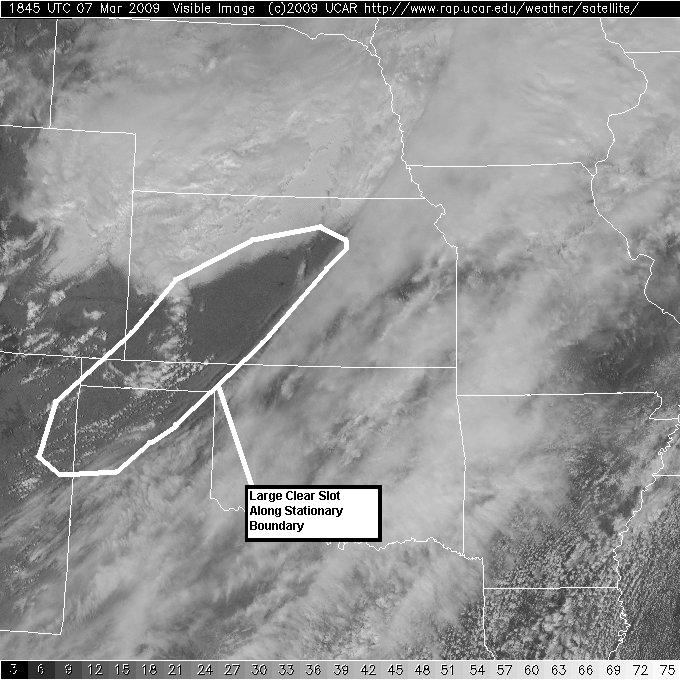
Image on the right shows a post analysis of a satellite image from that afternoon: surface-based convective towers can be seen in the eastern Oklahoma Panhandle and southwestern Kansas. The towers are developing in a relatively cloud free region (clear slot) left of the mid and upper-level jet axis. The 'clear slot' barely overlapped with the stationary surface frontal boundary over central Kansas. This allowed for more surface heating over the warm sector before storms devevelopment. I left Norman at 1pm under overcast skies, but as I approached the OK/KS border on I-35 the clear skies and convective towers were visible to my west-northwest. That type of scene always brightens my spirit and enhances my confidence for the chase.
|
 |
|
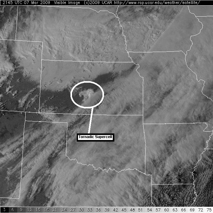
Image on the right shows a satellite image around the a supercell was producing a tornado in Central Kansas. The anvil and associated convective clouds with the tornadic supercell is circled.
|
 |
|
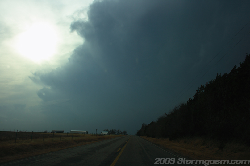
I watched the development of the 'Hutchinson Storm' to my west as I drove nortward on I-35. I was able to keep tabs on the storm both visually and by remote sensing, by periodically checking radar images on my phone. I was, also, in contact with my friends Juston and Corey. The cell began as a line of convective cumulus towers and transformed into a multi-cell storm. Eventually, the storm became more organized, a single updraft began to dominate, and it transformed into a single cell storm. I decided intercept the storm, which involved driving west-southwest, after it had begun to show supercell characteristics. It's always good to stay at least a county ahead of a storm early in its development to allow it time to get organized, because you don't want to get caught behind a fast moving storm before it has a chance to produce a tornado. The image on the right shows profile the developing supercell storm when it was still west of Hutchinson, KS. Not too long after this image was taken the storm became tornado warned. |
 |
|
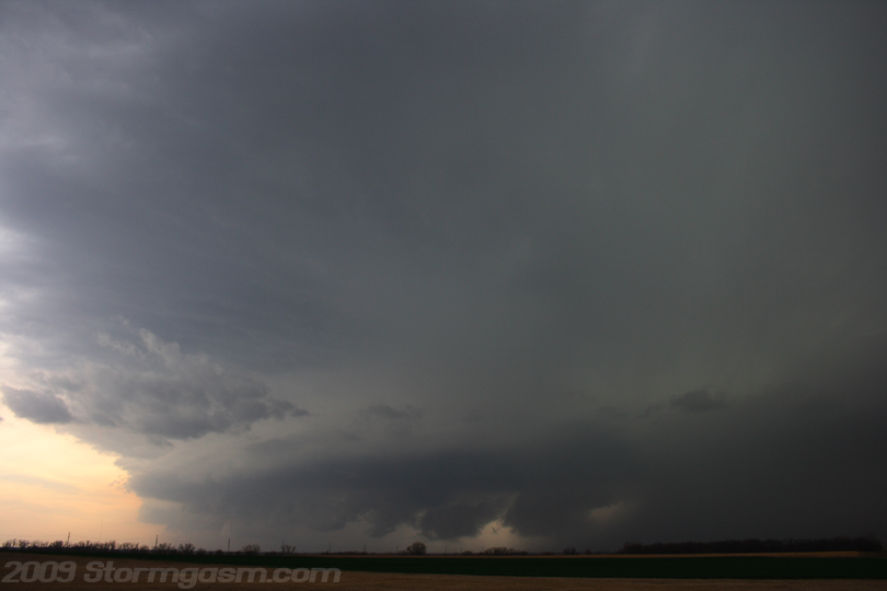
I positioned myself approached the storm from the northeast and positioned myself northeast of Hutchinson, KS; I had a great view of the entire storm updraft. It had good structure, which only got better as it approached my location. A tornado was apparently reported at the time of the image on the right. The location of the tornado would have been under the wall cloud according to the report, but no debris tight circulation could be seen from my location. I did, however, witness broad meso rotation. I thought the meso was still in the process of occluding at the time, so I wasn't really expecting this thing to produce a tornado for another 15 minutes. Image the right shows the tornadic supercell with inflow bands, heavy precip core, RFD gust front, and rotating wall cloud at the time of the Hutchinson, KS tornado reports.
|
 |
|
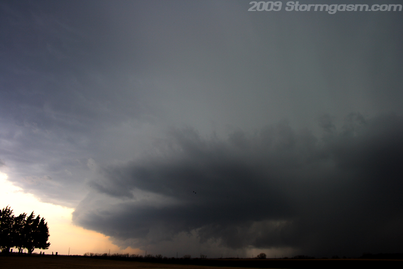
A little bit of time passed and the storm was closer to my position, also, it now appeared to be moving more ENE instead of NE. The RFD clear slot was really wrapping around the wall cloud and causing a nice occlusion, which can be seen in the image on the right. A central region of tight rotation began to develop on the left or southeastern side of the wall cloud. It appeared this storm was going to produce soon, which it did produce a few minutes after this picture was taken. |
 |
|
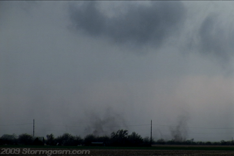
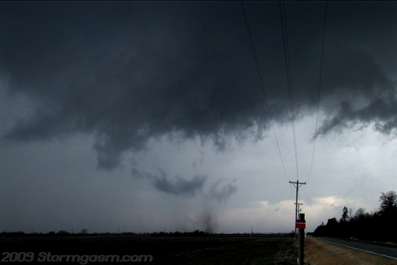
The meso was really close and very occluded with rapid rotation and finally a debris cloud developed underneath a barrel funnel/collar cloud. The debris cloud was broad and weak with smaller more intense vorticies spinning up inside. I counted 3 visible vorticies inside the larger slower debris/dirt cloud. The tornado probably lasted about 5 minutes before the debris cloud dissappeared and then dust kicked up by outflow became visible as outflow undercut the updraft and the storm became elevated. I then dropped the storm near Hesston. The image on the right is a video still and it shows one of the smaller vorticy debris clouds associated with this tornado. I can only guess, but this tornado looked like it was only capable of producing minimum EF1 damage at it's maximum intensity. It appeared to be a pretty weak tornado. |
 |
|
Image on the right is a video still, which shows two separate vorticies inside the larger tornado debris cloud.
|
 |
|
Image on the right (video still) shows the multiple vortex tornado between Buhler and Hesston, KS near Dutch Road.
|
 |
|
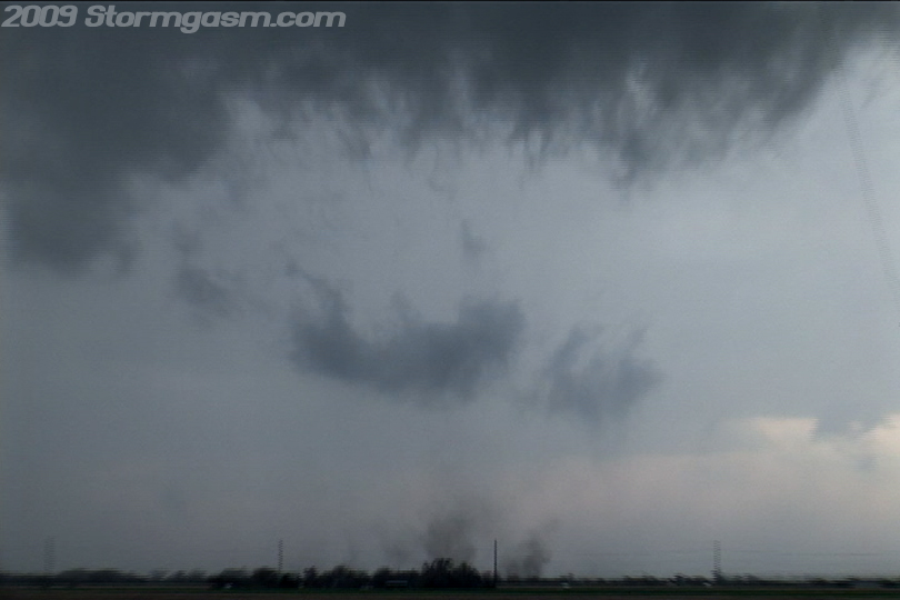
Image on the right (video still) shows the multiple vortex tornado near Dutch Road between Buhler and Hesston, KS. The misocyclone or tornado cyclone was almost completely cut off from the main updraft inflow at this point. The tornado dissipated a few minutes after this image. Outflow completely undercut the updraft and the storm became elevated. I saw a bunch of gustnadoes during and after the storm was undercut by outflow, but no more tornadoes developed. I dropped this storm near Hesston, KS and tracked southwest along a broken line of supercells (most were elevated as well). I got some sunset images and lightning shots and stopped to visit some friends in Wichita around 10pm. |
 |
|
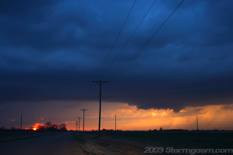
Image on the right shows and elevated supercell west of Wichita, KS at sunset. An elevated wall cloud can be seen on the right side of the image.
|
 |
|
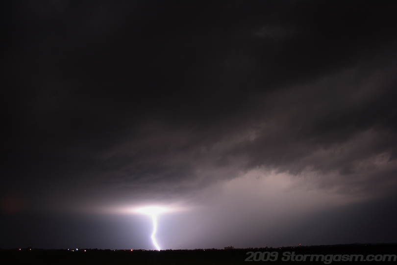
Image on the right shows a lightning bolt over open farm country WSW of Wichita, KS.
|
 |
|
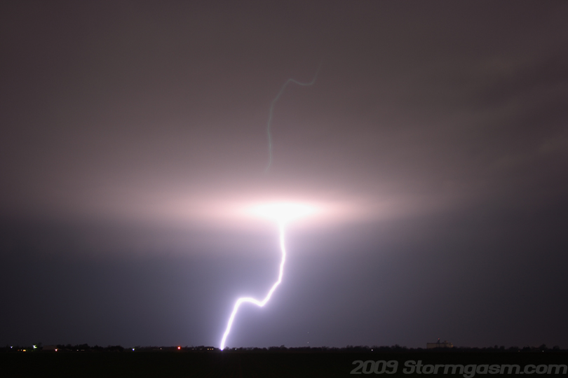
Image on the right shows a lightning bolt over open farm country west of Wichita, KS. I'm not sure why, but I'm getting a 'ghost' or mirror image from bright lights when shooting night shots. I never noticed it happening until last Halloween when I was trying to shoot Jack-O-Lanterns. It never happened before that with lightning, but now it seems to be happening with greater and greater frequency.
|
 |
Home
| Storm Store | Photo
Gallery | Message
Board | Storm Chases | Latest
News
Stock Footage | About
| Contact | Editorial
| Weather Links
Copyright 2004 Stormgasm.com. All rights reserved.