December 9-10th,
2007
Oklahoma
Ice Storm
| On
Sunday December 9th and Monday December 10th a very significant freezing
rain event occurred over Western, Central, and Northeastern Oklahoma.
In Norman, OK thousands were with out electricity as tree limps heavy
with ice snapped and pulled down power lines. I would have posted this
earlier, but my power was out for days and my internet just came up a
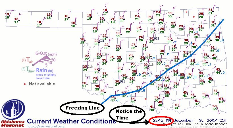
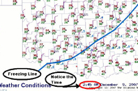
few hours ago (Thursday evening December 13th). The map to the left is
from the early morning hours on the 9th when the freezing line had recently
passed through Norman,OK; we were experiencing very heavy thunderstorms
at that time. |
 |
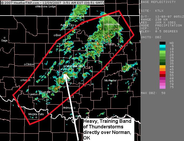
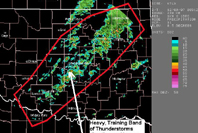
| The
image to the right is a radar image around the same time of the first
surface map. Very heavy thunderstorms with frequent lightning, high winds,
and smal hail were training over Norman,OK. |
 |
|
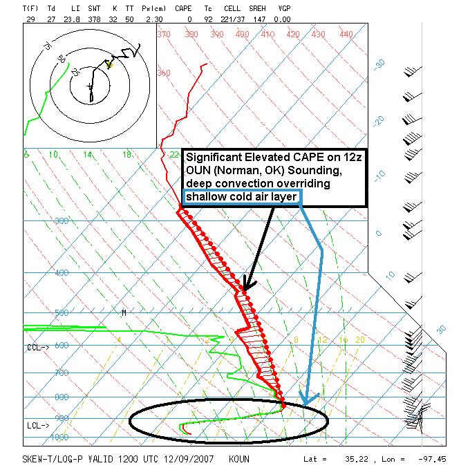
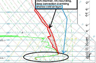
To the
right is the 12z sounding from the 9th showing the very, very shallow
sub-freezing airmass, which had advected under a significant region
of warm air advection at 900mb and above. Notice the saturated layer
up to 800mb and the 1000 to 2000 J/kg of elevated CAPE!!! This is as
'CLASSIC' freezing rain sounding as you can find!
|
 |
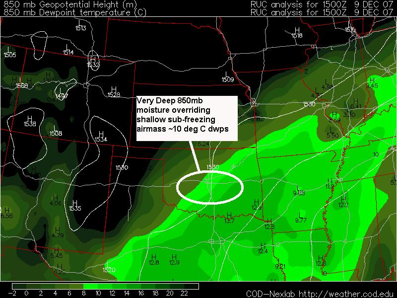
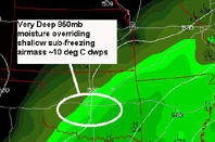
| This
is an 850mb analysis for the morning of the 9th: notice the very high
850mb dewpoints over running the cold airmass at the surface! Those dewpoints
are as high as 13 deg C at 850mb!!!! |
 |
|
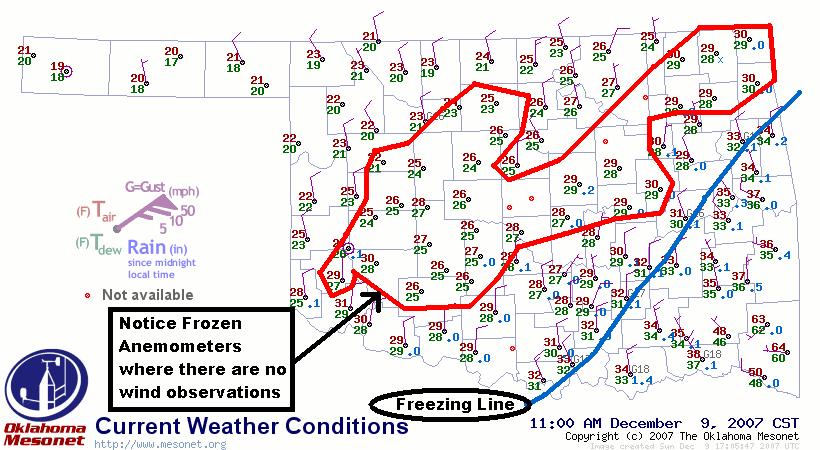
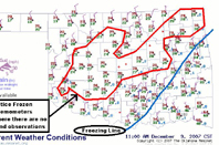
To the
right is a surface map at 11am on the 9th; already there is a significant
number of Oklahoma Mesonet stations not reporting wind due to the frozen
anemometers from the ice accumulation!
|
 |
|
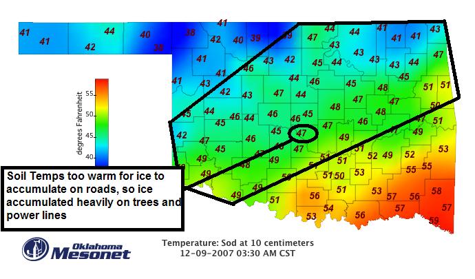
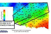
The right
figure is the 10cm soil temps in the afternoon on the 9th; notice most
of Central OK has soil temps in the mid-40's. The sensible heat release
and radiation emmitted from those warm surface temps prevented ice from
accumulating on the roads. But bridges were still able to receive ice
accumulation due to air passing underneath the bridges, which cooled
them down.
|
 |
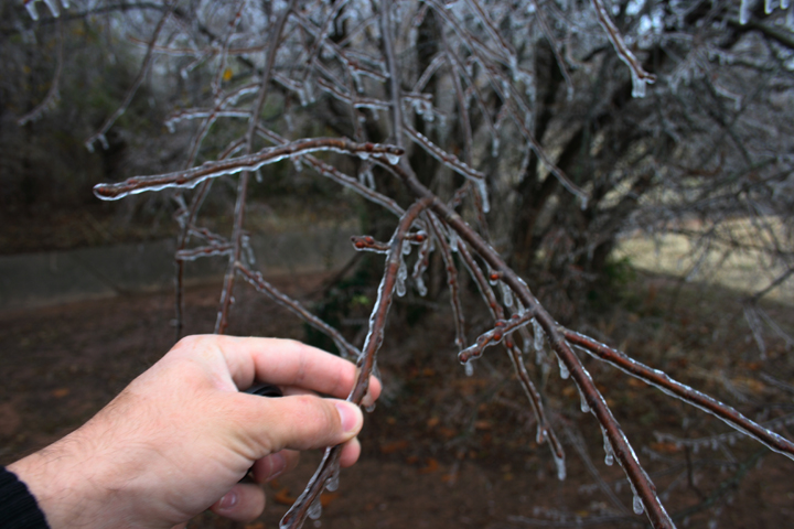
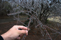
| The
pic on the right is from the morning of the 9th in Norman, OK; there really
wasn't much more than a glaze maybe a quarter of an inch thick on most
trees at this time. The trees were still sagging significantly at this
time. JUST WAIT FOR PICS LATER WHEN THERE IS MORE
ICE ACCUMULATION |
 |
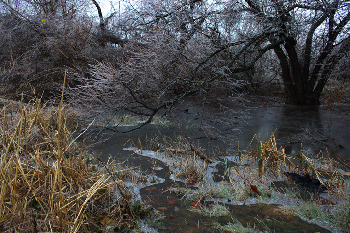
| The
pic on the right really isn't a pond, but I guess it became a temporary
pond due to the significant amounts of rain we had received. |
 |
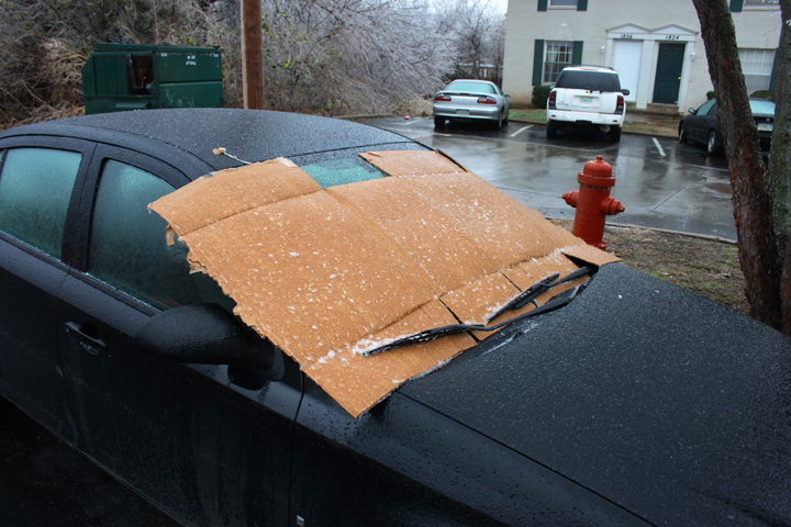
| It's
a good idea to cover your windshields before the freezing rain, snow,
or sleet begins, because it can be a pain to scrape that stuff off. I
used card board on my window. |
 |
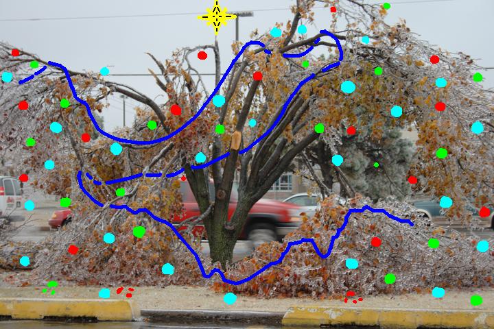
| Check
out this tree; it's leaning a bit with its branches sagging down, but
this is from the morning of the 9th, so I'll show another picture later
from the morning of the 10th when the REAL devastation hits Norman. |
 |
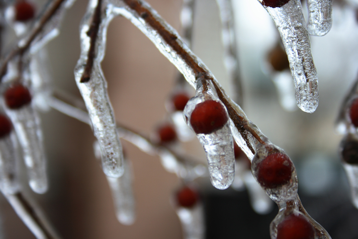
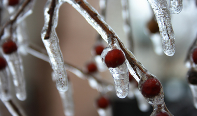
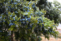
| A
nice close up of some berries on a tree branch looks pretty good, but
when you zoom out and look at the whole tree it starts to become a serious
hazard. |
 |
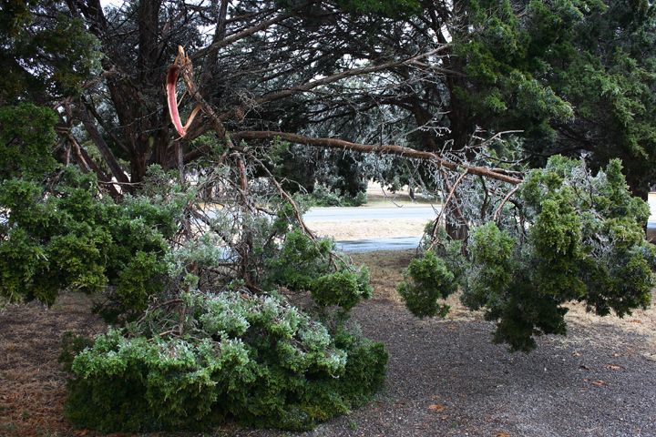
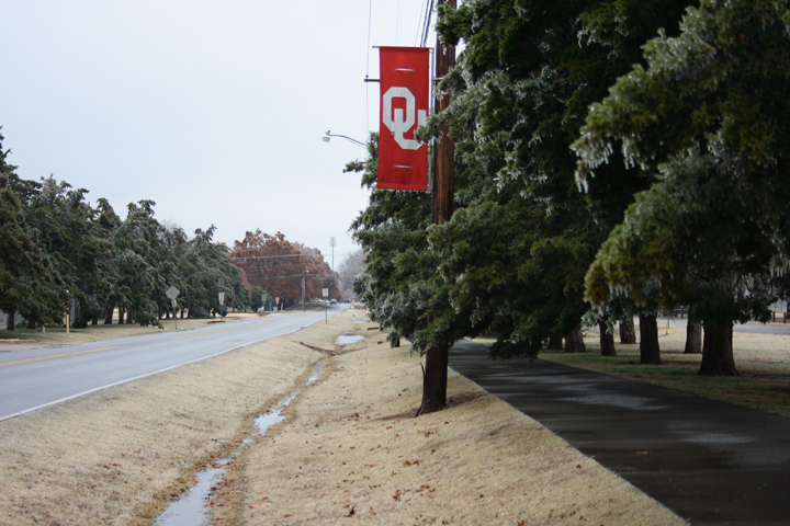
| Some
cedar tree damage next to OU's campus. Remember this damage is from maybe
a quarter inch of freezing rain. |
 |
| This
is a pic of Jenkins Ave. next to Reeves Park in next to OU's campus. I'll
put up another pic of this same street with the cedar trees from the following
day. |
 |
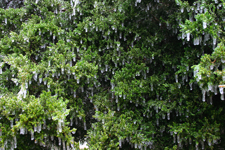
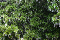
| This
is a close-up of a cedar tree branch. |
 |
| I
really like the different patturns you can find on a simple cedar with
ice. |
 |
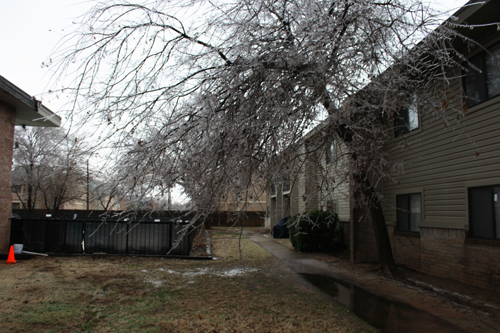
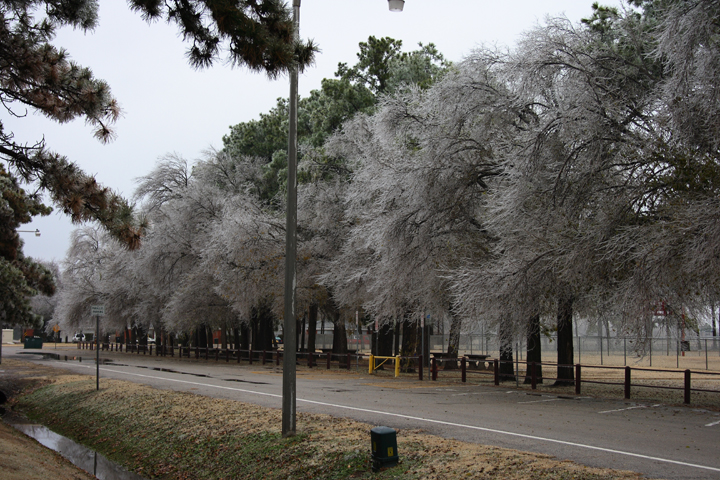
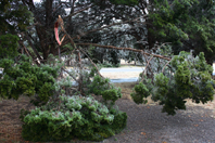
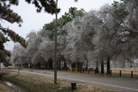
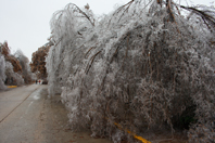
| Pic
of some trees at Reeves Park; these trees would be really messed up the
next day (the 10th). |
 |
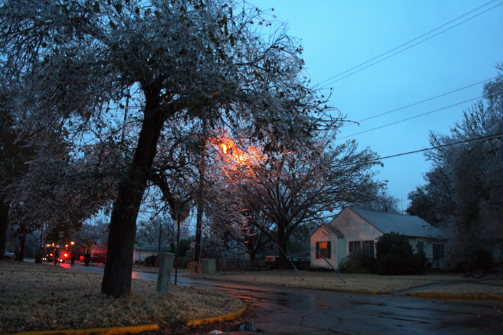
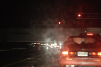
| I'm
really excited this pic came out! That orange-red glow in the tree is
not a street light, but an electrical fire from a power line that snapped
and fell across the road in front of me. I was lucky to have my camera
on me and I put it on a very high ISO (maybe 800) to keep it from being
too blurry. |
 |
| This
is a pic at night at a high ISO (1200) and the lense wide open! That is
a train blurring by and the opposing railroad cross bar is on the ground,
because the weight of the ice brought the bar to the ground instead of
hovering above the ground. This pic is from the night of the 9th. |
 |
| I
will put more pics from the night of the 9th and the day of the 10th up
when I can to show the destruction this ice storm brought on Norman, OK.
I'm not sure when I can get those pics up, because a significant snow
storm looks to hit this weekend, so maybe early next week. |
|
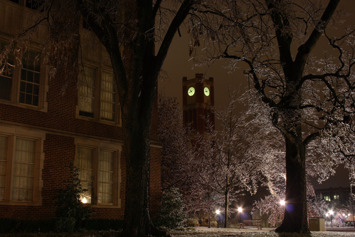
| Shot
of University of Oklahoma Library Clock Tower at night on the 9th. I really
like this shot! |
 |
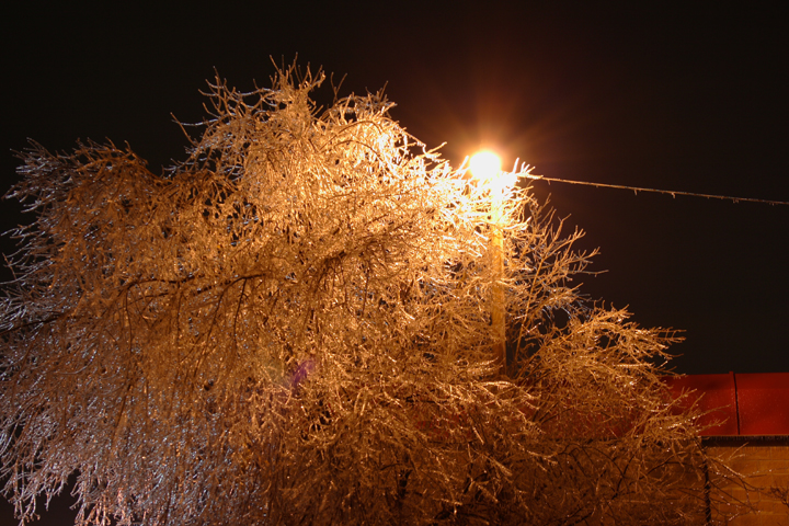
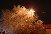
| Ice
glazed tree and street light; this tree has quite a bit of ice accumulation.
I only had time to take 2 pics, because a thunderstorm was already dropping
rain on me, which ended up being a long line of continous storms lasting
the remainder of the night and going into the morning of the 10th. |
 |
|
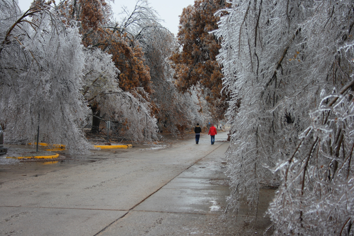
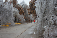
From
this point on are pics from the 10th of December:
A pair
of adventurous people walk among the snapping, ice-covered trees near
the University of Oklahoma dorms.
|
 |
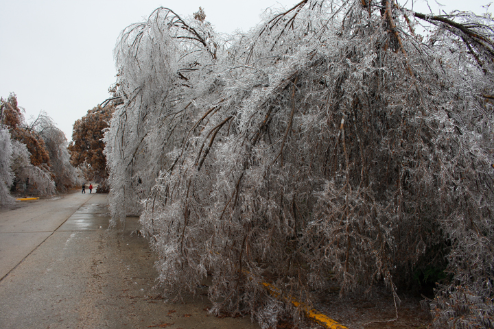
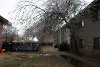
| This
poor tree was grounded; I passed by this tree 4 hours later and all those
sagging branches were completely snapped! |
 |
|
Due
to time constraints with Christmas and New Years approaching I will
not be able to load any more pics for the next two weeks. I will try
to get more pics up after New Years.
Happy
Hollidays!
|
 |
Home
| Storm Store | Photo
Gallery | Message
Board | Storm Chases | Latest
News
Stock Footage | About
| Contact | Editorial
| Weather Links
All
storm chasing (tornado, supercell, lightning, hail, sunset, ect.) photos and
videos are copyright property of Jim Bishop and Simon Brewer (Stormgasm),
unless otherwise specified. Any unauthorized reproductions are strictly prohibited
by law.
Copyright 2004 Stormgasm.com. All rights reserved.