November 5th, 2008 Central Okalahoma Storms
|
November 5, 2008: Simon Brewer, Juston Drake, and Mark McGowen chased outflow dominant supercells across central Oklahoma. The November setup appeared favorable for the possiblity of supercell storms and a small chance for tornado development. Simon, Juston, and Mark were just happy to see severe storms. The chasers documented nickel and quarter-size hail north of Edmond, OK, high winds, and frequent lightning. Areas of ground east and northeast of Guthrie, OK were covered in hail, which caused thick hail fog. The chasers intercepted a storm that appeared to be an outflow dominant supercell near Edmond, OK in the late afternoon/early evening. Mark and I drove to Blackwell, OK to meet up with Juston. We left Juston's car in Blackwell and repostitioned to the south near Perry, OK. |
|
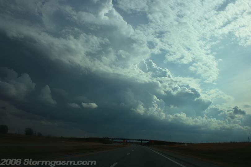
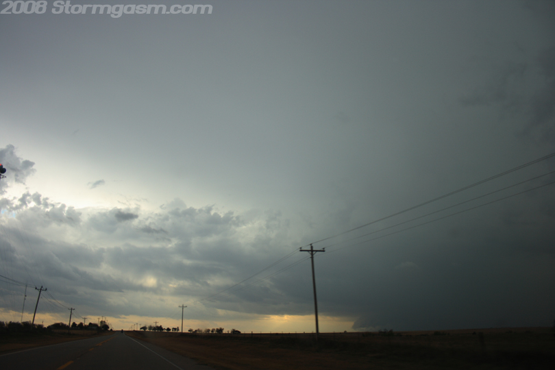
The dynamics appeared more favorable for north-central Oklahoma and southeastern Kansas for tornadic supercells, but a cirrus deck was persistent over that region limiting surface heating. The chasers then moved south where higher instability appeared more favorable for surface-based storms. The shear appeared adequate for supercells across central and northern Oklahoma, but further south the low-level shear needed for tornadoes did not appear favorable. The image on the right is looking south on I-35 near Perry, OK at a developing low-topped supercell. This storm would later become tornado warned, but no tornadoes were reported. |
 |
|
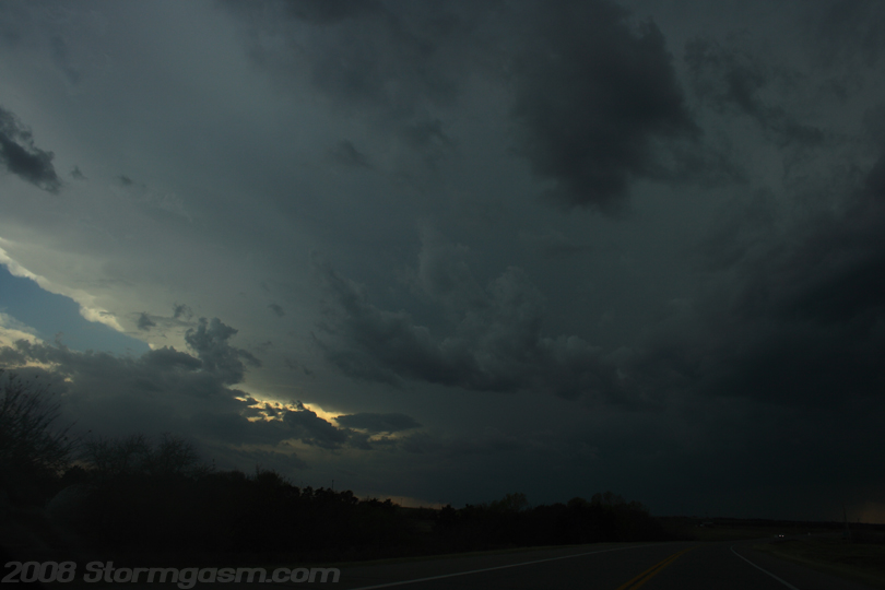
Strong mid-level winds created fast storm motions; approximately 40+ mph. A well-organized cell developed southwest of El Reno, OK, and the cell appeared to be moving into a favorable environment for further strengthening, so the chasers drove southwest hoping to intercept the storm north of Oklahoma City. The image on the right shows the anvil of the storm to the southwest of the chasers position. |
 |
|
The image on the right shows the storm near Piedmont, OK where baseball-size hail was reported. The southern edge of the anvil can be seen along with a well-developed rain shaft and inflow bands. There appeared to be a low cloud feature at the base of the updraft, but it appeared to be dominated by outflow. |
 |
|
Image on the right shows the same storm approaching the storm chasers location northwest of Edmond, OK. Well defined inflow bands can be seen along with a 'shelf' cloud feature. |
 |
|
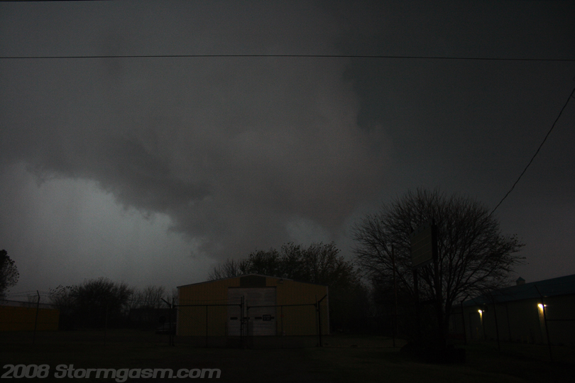
We let the storm overtake our position since the day was getting late and light was quickly disappearing. There were many interesting low cloud features associated with this storm, but all seemed to be driven by cold outflow. We experienced nickel to quarter-sized hail as the storm overtook our position north of Edmond. The image on the right shows a low outflow dominant cloud feature moving quickly to the northeast of our position. |
 |
|
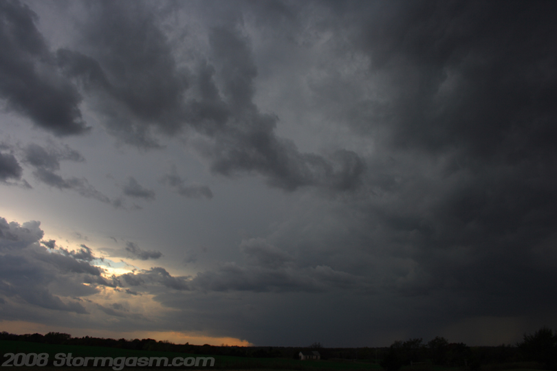
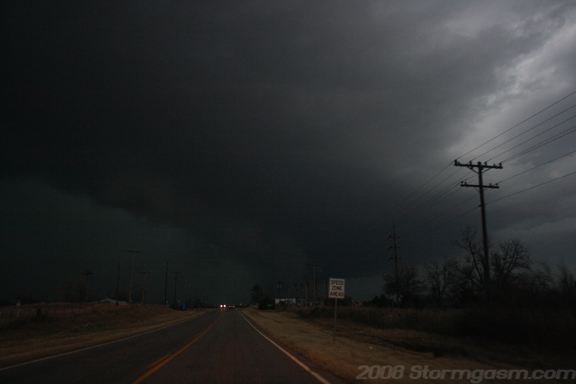
We got caught in traffic attempting to recapture the updraft of the storm and were finally able to reintercept the storm northeast of Guthrie, OK. The storm appeared to be completely outflow dominant and light was fading, so we called it a day. I drove Juston to his car in Blackwell, OK and Mark and I drove back to Norman. The image on the right shows a shelf cloud associated with the main updraft of the storm. |
 |
|
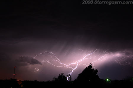
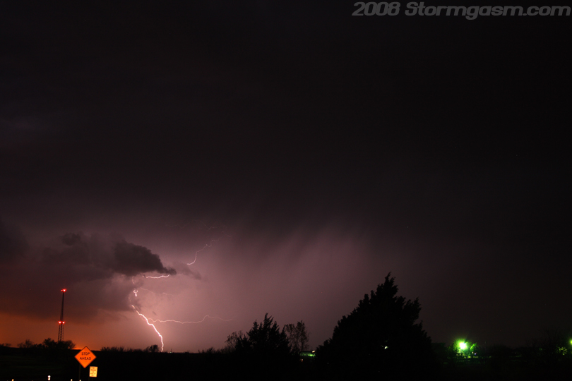
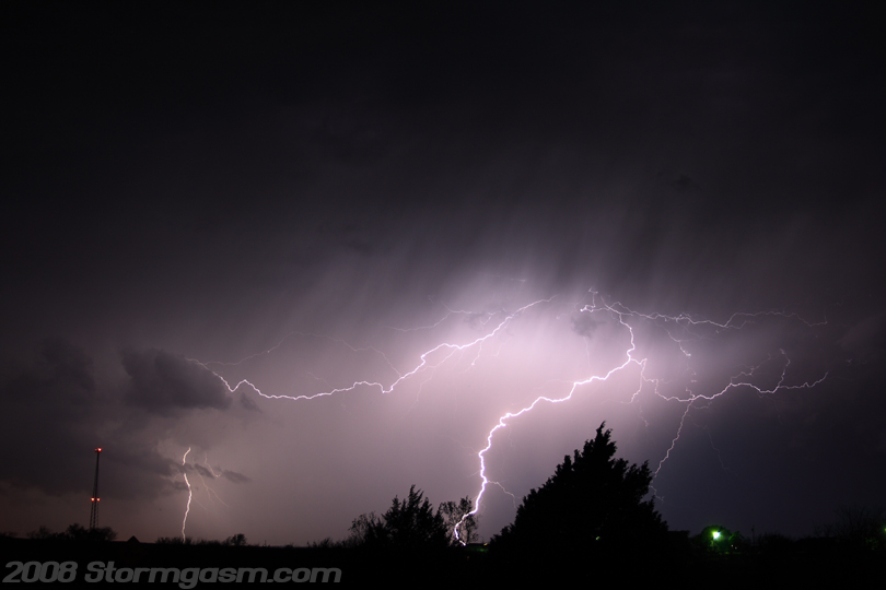
On the drive back to Norman Mark and I encountered some elevated storms near Guthrie, OK. The lightning seemed frequent, so I stopped the car and took some pics. The image on the right shows a lighting strike southwest of our location. |
 |
|
Image on the right shows a distant lightning strike closer to the lights of Guthrie, OK (orange glow on the left side of picture). |
 |
|
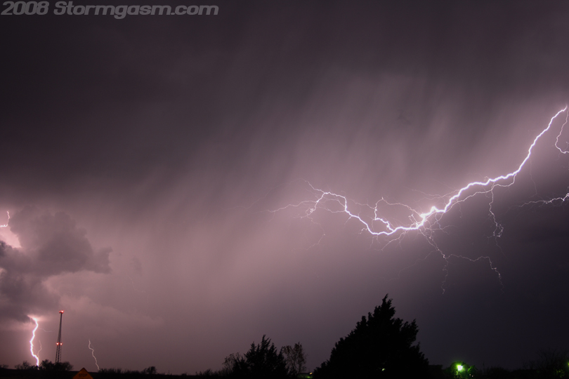
Image on the right shows two lightning strikes over central Oklahoma. |
 |
|
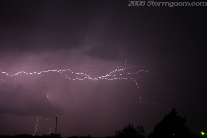
The image on the right shows three lightning strikes; two cloud-to-ground and one cloud-to-cloud. |
 |
|
Three lightning strikes can be seen in the image on the right. Light to moderate rain began to fall at our location, so I had to stop taking pics of the lightning. One day I need to get a window clamp with a cover to continue shooting lightning pics with or without rain from the comfort of my car. |
 |
Home
| Storm Store | Photo
Gallery | Message
Board | Storm Chases | Latest
News
Stock Footage | About
| Contact | Editorial
| Weather Links
Copyright 2004 Stormgasm.com. All rights reserved.